In the spring of 1916, on the north bank of the Susitna River in the Alaska Territory, a grading crew returned to a section of railway they had finished the previous September, only to find that parts of their work were no longer where they had placed them. The cut into the high side had caved in. The surface they had leveled in the fall had settled in places by more than a foot. The material beneath the ties had softened to a consistency that held a man’s footprint even after he lifted his foot.
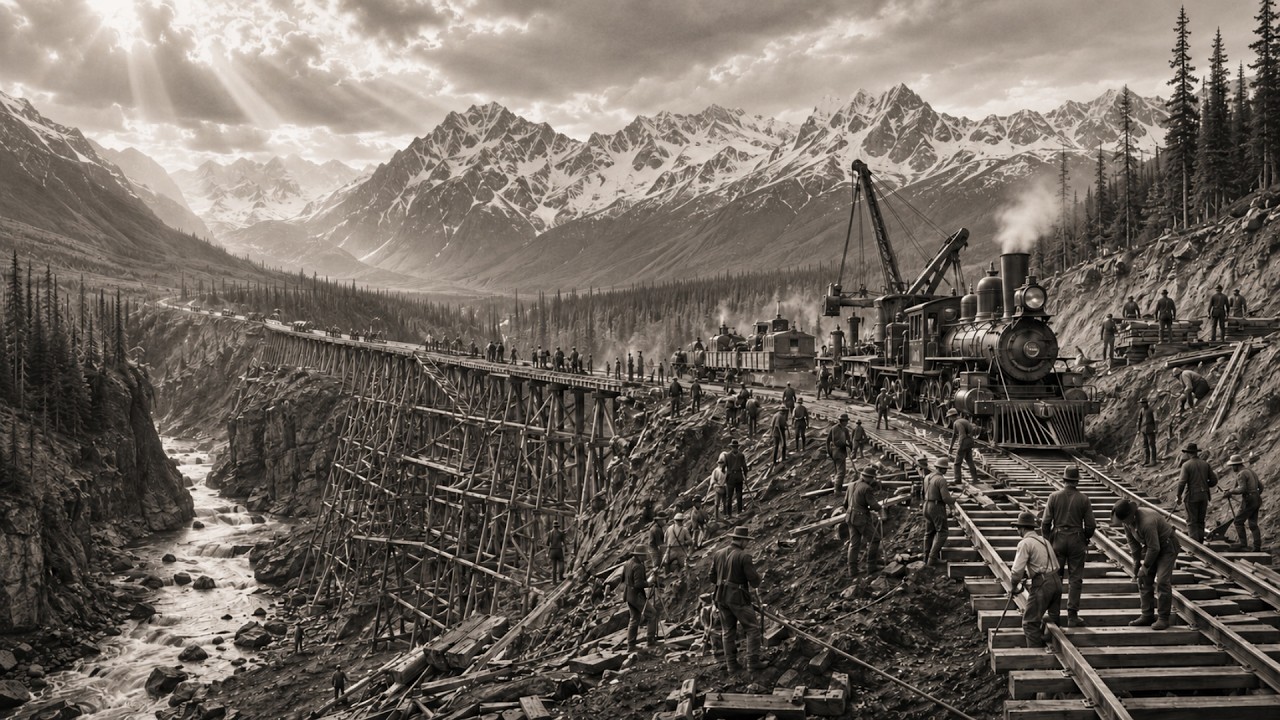
They had leveled solid ground in September. What they stood on in May was no longer solid ground. The winter had not restored it. The material beneath that track was permafrost—ground that had remained continuously frozen for hundreds of years in some places and thousands in others, reaching depths of hundreds of feet in spots—and this frozen layer stayed stable as long as the insulating cover of tundra vegetation above it remained undisturbed.
When the grading crew stripped that cover in the summer of 1915 and exposed the frozen material to direct sunlight and Alaskan summer air temperatures, they set in motion a thaw that the following winter could not reverse. The melted material no longer had any capacity to bear weight. The track they had built on it began to settle toward a new equilibrium. That equilibrium was lower than the track they had constructed.
This was not a slope failure. It was not a drainage error or a compaction mistake. Every major railroad built in North America before 1915 had been built on ground that responded to standard engineering methods. The textbooks available to the Alaska Engineering Commission contained grading specifications, compaction tables, and drainage calculations for every terrain condition that half a century of transcontinental construction had documented.
But there was no chapter on permafrost in any of them. There was no chapter to copy. The Alaska Engineering Commission would have to write it themselves, section by failed section, while at the same time trying to build 470 miles of mainline railroad across the most remote construction environment on the continent. The Alaska Railroad had been authorized by an act of Congress in March 1914, and it was built directly by the federal government, which made it unlike every transcontinental railroad that preceded it.
There was no private company. There were no competing land grants. There was no Henry Villard demanding completion before a financial deadline. The decision to build it was federal because the project’s economics would not support private investment.
The expected freight revenues from within Alaska—from the coalfields of the Matanuska and Healy valleys, and from the gold operations around Fairbanks—were real. They were not real enough to cover construction bonds on a return-on-investment schedule that any private company could justify. The federal government built it because it was the only entity capable of doing so, and because the alternative was leaving the largest portion of American territory permanently isolated from its ports. The route ran 470 miles from the port of Seward on the Kenai Peninsula north through the lowlands of Cook Inlet, up the Susitna River basin, across the Alaska Range at Broad Pass, then north through the Nenana River basin to Fairbanks.
Broad Pass, the crossing point of the Alaska Range, sits at 2,363 feet above sea level. The grade at the summit was about 0. 6 percent. By the numerical standards that had defined the engineering problems at Kicking Horse Pass and Stampede Pass, crossing the Alaska Range looked straightforward.
It was not. What the numbers did not reflect were fifty miles of frozen terrain at the southern approach, canyon conditions at the northern approach, and a supply chain that meant every pound of steel and every stick of explosive had to be shipped from the continental United States by ocean freight to a tidewater port before it could move a single step toward the construction site. By 1920, when active construction was 350 miles north of Seward, a single supply operation for a blasting job in the Nenana River section required coordination across more than 2,000 miles of sea and land transport before materials reached the work site. The man in charge of building the Alaska Railroad was Frederick Mears.
Born in 1878, trained as an engineer at the United States Military Academy at West Point, he had served in the Army Corps of Engineers on the construction of the Panama Canal before his assignment to Alaska. The Panama Canal had been built through tropical terrain at sea level with a workforce that at its peak numbered in the tens of thousands and a federal budget that was, by the standards of that era, effectively unlimited. What Mears inherited in Alaska in 1914 was a 470-mile surveyed route through terrain with no engineering precedent, a workforce he had to recruit from the labor markets of the Pacific Northwest and transport north by steamer each construction season, a supply operation entirely dependent on ocean shipping, and a ground-condition problem that no available textbook addressed. Mears moved the Alaska Engineering Commission’s operational headquarters to Anchorage, which in 1915 was a survey camp of a few hundred people on the shore of Cook Inlet.
He established the supply depot at Seward, set up a system of construction camps at intervals along the line, and began grading north from the lowlands in the summer of 1915. The first season’s work looked like progress. Roads were cut, gravel was placed, rail was laid. By the end of 1915 the line extended roughly fifty miles north of Seward, and the commission had begun operating the completed portion as a commercial carrier, moving freight and passengers on a railroad that was still under construction north of the operating railhead.
That partial operation continued for six more years, with revenue freight moving behind the construction crews as the work advanced north each season. The freight money offset part of the construction costs. The partial railroad was paying part of the cost of the permanent railroad. It was not a solution.
It was a way of managing the gap between what was finished and what still needed to be completed, while the finished portions fell apart beneath them at the same time. The permafrost problem appeared in every annual report the Alaska Engineering Commission submitted to Congress from 1916 to 1923, not as a headline item but as a line in maintenance expenditures. Lengths of track needing re-ballasting, embankments needing rebuilding, sections the operating department had accepted in September requiring complete reconstruction by the following July. Commission engineers developed mitigation methods as construction progressed: raised roadbeds that kept the tie surface above the thermal range of the disturbed permafrost layer, specified gravel depths, and drainage patterns designed to limit the lateral spread of thaw.
These methods reduced the rate of settlement in new construction. But they did not eliminate it, and they could not be applied retroactively to the early sections built before permafrost behavior was understood. Those sections kept settling until they reached equilibrium, and maintenance crews kept rebuilding them until they stopped. The permafrost records in the commission’s files grew longer every year.
The cost of the permafrost problem was not measured in fuel bills as Big Hill had been, or in hours of reversing as the Stampede Switchbacks had been. It was measured in repeated construction. A section of road that cost the commission money to grade, ballast, and track in 1916 cost the commission that money again in 1918 when settlement required rebuilding, and in some locations three times. No line in the commission’s operating reports reads “cost of permafrost rebuilding.
” The figure is distributed across maintenance entries and construction adjustments over eight years of annual reports. The commission never announced that total. Congress received the annual reports. The annual reports described progress.
The Nenana River valley on the north side of the Alaska Range was the single hardest part of the entire line. The Nenana drains the north face of the range through a valley where the walls in the steepest sections close directly onto the river’s edge, leaving no room for a surface grade. The route through the valley required cutting benches into the valley wall itself at heights above the river where the only available foundation was what the volcanic rock formations provided. In several locations the valley wall had been undercut by the river and leaned outward over the running water.
The men leveling those benches worked on a face hanging over a glacier-fed river, with no platform beneath them except what they built themselves. The rock in the Nenana valley is volcanic. In the solid sections it produced clean fractures along the blast pattern and predictable spoil piles. In the shattered contact zones between formations, where groundwater and the river’s action had worked on the rock over geological time, a blast could open a face that required immediate timber support to prevent collapse.
The men installing the timber frames in the valley sections after blasting worked in a tight space filled with blast smoke and rock dust in a canyon that channeled the valley winds at temperatures that fell in January to below forty degrees Fahrenheit below zero. When the temperature drops below forty below, the properties of steel change. Drill steels that are flexible at twenty below become brittle at forty below, and brittle steel under hammer blows can break. The break happens at the instant of the strike, and the broken end flies in the direction of the hammer’s motion—toward the man holding the steel.
The commission’s medical records used the category “accident” for the injuries that resulted. That category does not describe the mechanism. The construction method on the canyon faces was the same method used at Kicking Horse and Stampede Pass. Double-jack drilling.
Two men working one face together. One man holds a steel drill against the rock, turning it a quarter turn between blows to keep the cutting edge biting into fresh material. The second man swings a heavy double-headed hammer in a rhythmic arc, striking the end of the drill with each downward swing. On the hard volcanic rock of the Nenana valley, a double-jack crew could drill a three-foot hole in about thirty minutes.
In the shattered, waterlogged sections the same hole might take an hour, and a full blast pattern on a canyon face required between sixteen and twenty-four individual holes. Center holes angled inward to give the charge a point of relief, perimeter holes defining the edge of the planned excavation. After all the holes were loaded and the fuses connected in sequence, the crew withdrew, the fuses were lit, and the blast went off. After the blast, the working face was unreachable.
The smoke and fumes from the charge had to disperse before men could re-enter. In the section of canyon with a strong air current from the river, this took thirty to forty-five minutes. In the longer tunnels where the valley wall had been penetrated far enough to weaken the natural draft, it took two hours. During the wait, the mucking crew and the timbering crew were staged at the tunnel entrance.
When the dust cleared from the face, they went in to work. The spoil was loaded by hand into ore cars on a temporary track and hauled out of the tunnel. Horses pulled the ore cars. The rock was dumped at the tunnel entrance.
The drilling crew returned to the new face and the cycle began again. The rate of progress on a well-run solid rock face in the Nenana valley using this method was about four feet per day per face. The men who worked those faces were recruited through labor agents in Seattle and shipped north by steamer to Seward at the start of each construction season. The Alaska Engineering Commission’s workforce at the peak of construction included men from across the continental United States, from Pacific Northwest immigrant communities with experience in hard-rock mining and railroad grading, and from Alaska Native communities in the interior.
The average worker on the commission payroll during the peak construction years earned the Alaska Engineering Commission’s documented wage rate—per the record, 126 per day. The wage differential from continental rates existed because the isolation was real. A worker seriously injured at a Nenana valley site was, depending on the construction year, between 200 and 350 miles from the nearest hospital equipped for surgery. The commission maintained field hospitals at the major construction camps, staffed by a physician and a small nursing crew.
In cases of serious injury, the procedure was to move the man on the next southbound train toward Anchorage or Seward. In the early construction years, that train ran on tracks laid the previous season over permafrost that was still settling. The commission’s annual reports to Congress record the deaths that occurred during the active project period. The reports are precise about miles of track laid each season, expenditures by category, and the volume of freight moved on the partially operating railroad.
The deaths appear aggregated by cause category, consistent with how the Canadian Pacific recorded deaths at Kicking Horse and how the Northern Pacific recorded deaths at Stampede Pass. The individual names behind the aggregate numbers require cross-referencing with the commission’s administrative correspondence and payroll records held in the National Archives in Washington under Record Group 126, Alaska Engineering Commission files, and in the historical collections of the Alaska State Library in Juneau. The commission’s records show the total death count from the annual reports of the Alaska Engineering Commission to Congress from 1915 to 1923 during the construction period. The cause categories include accidents, which cover rock falls, blast injuries, falls from structures, and equipment failures without distinguishing between them.
Exposure is a separate category covering deaths from hypothermia, frostbite, and deaths in cold conditions where the mechanism was not established to the commission’s satisfaction. Drowning covers deaths on a line crossing more than twenty significant streams and rivers, many of which were bridged with temporary timber structures during active construction. The remaining deaths carry a general category. Herrick Gulch bridge is the structure most riders of the Alaska Railroad remember.
It crosses a gulch 354 miles north of Seward at the southern entrance to the Alaska Range. The gulch drops from track level to the stream below. The bridge is a steel deck structure. When completed in 1921, it was the highest bridge on the Alaska Railroad and one of the tallest railroad bridges in North America by deck height.
The engineering problem at Herrick Gulch was not the span. It was the abutments. The bridge transfers the load of every train crossing it through the structure to the ground at its two end abutments. The valley walls at the abutment locations at Herrick Gulch contain permafrost at depth.
If the thermal effect of the bridge structure or the seasonal temperature changes in the canyon caused thawing to begin in the abutment foundations, the foundations would move. An abutment that moves is an abutment that fails. Mears’s engineering staff designed the Herrick Gulch abutments with a mass and foundation depth calculated to prevent the bridge’s thermal influence from reaching the permafrost layer beneath the abutment bases. That calculation required knowing exactly where the permafrost was at both abutment sites before the bridge structure existed to provide any access platform.
Those test holes were drilled by hand using rope staging on the canyon face in the winter of 1920 above the gulch slope. Two men per platform, one holding the steel, one swinging the hammer, in temperatures that did not rise above forty below in that gulch during January. The holes reached whatever depth was required to penetrate the permafrost layer completely. The data extracted from the holes was sent to the engineer.
The engineer wrote the calculations. The abutments were set at the calculated depth. The bridge steel was fabricated in the continental United States, shipped by sea to Seward, stored at a forward supply point on the line, and moved to the site when the roadbed level was ready to receive it. Erecting the bridge abutment required building a temporary structure from the canyon floor.
Timber frames rising from the gulch bottom to the underside of the bridge deck, made from timber cut near the site and processed through a portable sawmill set up in the gulch. The men who built the temporary structure worked up from the canyon floor through the winter of 1920 into 1921 in an area subject to spring flooding. They had to place the critical parts above the flood line before the spring melt arrived. The pace of the temporary structure construction was set in March and April of 1921 by the expected flood date, not by what the crews could safely endure.
The temporary structure was dismantled after the bridge deck was completed. The parts not removed when the spring flood arrived in 1921 were swept down the stream by the meltwater. The bridge held. The calculations were correct.
The abutments never moved. The bridge has been in continuous operational service since 1921. Mears was on site throughout the active construction period. Commission correspondence in the National Archives from 1917 to 1922 shows him writing monthly progress reports to Washington, tracking advance rates in the Nenana Canyon sections against schedule, managing coordination between the construction front and the operating railway behind it, resolving permafrost problems surfacing in maintenance reports, and rendering an accounting of every mile of progress and every dollar of expenditure to the Congress that appropriated the funds and expected to see the railroad it had paid for.
He was 45 years old when the line was completed. Surviving photographs show a trim figure in a wool coat standing on survey ground with a roll of blueprints under his arm, the Alaska Range clearly visible on the horizon behind him. He does not look like a man who built a railroad across the hardest permafrost terrain in North America. He looks like a man who spent eight years in field work, carefully counting the remaining days in his appointment calendar.
President Warren Harding arrived at Nenana by train on July 15, 1923, and drove a ceremonial golden spike into a pre-drilled tie on the main line of the Alaska Railroad. He was the first American president to visit Alaska while in office. Photographs of the ceremony show hundreds of people on the station platform at Nenana. Harding wears a dark suit.
The locomotive behind him is the standard Alaska Engineering Commission engine, the same type that had been hauling construction materials along the line since 1915. He looks like a man in the middle of a long official journey, with one final ceremony to complete before boarding a ship back to the continental United States. Harding died in San Francisco on August 2, 1923, eighteen days after the ceremony at Nenana. The cause of death was recorded as a heart attack.
He was 57 years old. The Alaska Railroad, the last major infrastructure project he officially opened, outlived him by more than a century. Ownership of the railroad passed from the federal government to the State of Alaska under the Alaska Railroad Transfer Act. With the transfer taking effect in 1985, the Alaska Railroad Corporation operates the line today.
Coal moves from the Healy fields south to the port at Seward. Container freight moves north to Anchorage and Fairbanks. Passenger trains run along the route in summer, carrying tourists through the Susitna valley and across the Alaska Range toward Denali. Herrick Gulch bridge is on that route.
Passenger trains cross it at the line’s posted speed. The canyon falls away far below the windows. The crossing takes about forty-five seconds. Below the bridge deck, in the canyon walls at both ends, the permafrost lies at the depth the drilling crews measured in January 1920, and the bridge foundations rest above it where Mears’s engineers placed them.
The bridge has never moved. The permafrost that caught the grading crews by surprise in 1915 on the north bank of the Susitna River is still there. It is less stable than it was in 1915. Climate change has accelerated thawing in parts of the roadbed that held together through the first half-century of the railroad’s operation.
The Alaska Railroad Corporation’s maintenance department manages permafrost-related ground failures as a recurring operational condition. The problem the first workers found in the spring of 1916—ground settling, the tie level dropping, material that was frozen in September and was not frozen in May—is the same problem maintenance crews address today, with better equipment and worse ground stability than the men initially faced. What comes to mind at Herrick Gulch is not the bridge. It is the men who worked the rope staging on the canyon face in January of 1920.
They drilled the test holes into frozen rock with hand steel and a double-jack hammer, turning the drill a quarter turn between blows in temperatures that made the steel itself a hazard at forty below. They did not know what those holes would show. They drilled them and handed the measurements to an engineer, and the engineer made his calculations, and the bridge has not moved in more than a century of Arctic winters, spring floods, and the continuous weight of loaded freight trains crossing at full speed. The names of those men are in the Alaska Engineering Commission payroll records, if the payroll records for that period survived the century in the federal archives.
Some names from the canyon construction period can be recovered from the commission’s administrative correspondence. Most cannot. The men who held the drill steels on the rope staging above Herrick Gulch are either in the payroll records or they are not in the records at all. The train crosses the gulch in forty-five seconds.
Passengers take their photographs. The train continues north toward the Alaska Range and down the other side toward Fairbanks. The canyon closes back in on the holes the men drilled. That is the work.
The valley drops away beneath the bridge, and the track runs on.
