In the summer of 1875, a United States government expedition moved through what is now northeastern Wyoming. They were surveyors and mapmakers, men carrying instruments and notebooks, tasked with measuring and naming a landscape the federal government had decided needed measuring and naming. At some point during that expedition, one of those men looked at something rising out of the plains and wrote down two words that have stuck ever since. Bad thunder.
That was what they heard. That was what the interpreter translated. And somehow, between that translation and the written record, “bad thunder” became “Devil’s Tower. ”
The new name suggested something evil, something supernatural, in the most Western and Christian sense of the word.
A devil’s dwelling. A place deserving fear. Except that was not what the original name meant. Not even close.
What the original name actually described was something far more interesting and far more precise. And when you understand what it really meant, and when you follow that thread through the layers of mistranslation and deliberate renaming that define so much of the documented history of this continent, you end up in an unexpected place. You end up asking questions the official record never particularly cared to answer. Questions about what that formation actually is.
Questions about who might have built what you are looking at when you stand at its base. Questions about why every indigenous nation that came into contact with it told stories that sound less like myths and more like memory. Memory of something that existed before the plains became empty. Before the expeditions arrived with their notebooks and their two-word names for things they did not understand.
The expedition that named Devil’s Tower was part of a military survey led by Colonel Richard Irving Dodge, accompanying a scientific team assessing the Black Hills region, ostensibly looking for mineral resources. The Lakota had treaty rights to the Black Hills. The government was looking for reasons to renegotiate those rights, and finding gold was exactly that kind of reason. When the expedition reached what is now Crook County, they found themselves looking at a geological structure unlike anything in their documented experience.
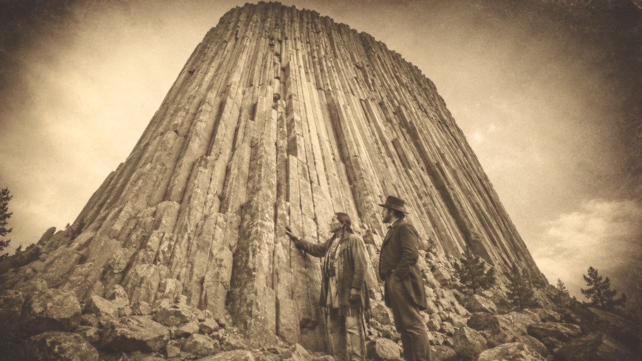
A rock mass rising nearly 1,300 feet above the surrounding terrain. Vertical stone columns. A flat top that seemed almost deliberate in its geometry, something that looked—depending on your angle—either like a natural wonder or like the stump of something that had once been much larger. The interpreter was trying to convey what the local indigenous population called the formation.
The name most often cited in Lakota is “Mato Tipila,” which translates to “Bear Lodge. ” The Kiowa name is translated various ways, including “Tree Rock” or “High Place on Rock. ” Nuances that depend on dialect and on who recorded them. Every nation in the region had its own name.
None of those names carried demonic connotations. What the interpreter conveyed to Dodge in that incomplete exchange was something involving the word “bad. ” Dodge or someone in his party heard the word “bad,” and they reached for the closest cultural equivalent in their own framework. “Bad” meant evil.
And evil on the Wyoming plains in 1875 meant one thing. The name was written down. It entered the geographic survey records. It appeared on subsequent maps.
And once a name appears on a government map, it tends to stay there with a permanence few things in this world achieve. The rock formation was not officially declared a national monument until 1906, when Theodore Roosevelt made it the first site designated under the Antiquities Act. By that time, the name had been in the records for three decades, and an entirely new legend had grown up around it, belonging to American settlers and mapmakers. The old names and old stories were reclassified as folklore, beliefs of people who did not write things down.
But they did write things down. Not always in alphabets that European scholars recognized. But they wrote and recorded and remembered with a precision that tends to be underestimated by people who decided in advance that there was nothing worth noting. Here is what the name “Mato Tipila” actually means and why the distinction matters.
“Bear Lodge. ” Not bear as in animal, though the bear appears in almost every story connected to this formation. Bear in the sense of spirit, guardian, inherited power. “Lodge” in the sense of a house, a dwelling, a place where something lives that existed before the people telling the story now.
Bear Lodge in the Lakota understanding is not a description of what the rock looks like. It is a description of its function. Why it exists, and what lives in or near it. When the Kiowa say “Tree Rock” or “Tree Stump,” they are describing something visual.
The stone columns look, from a certain distance, like wood. Like a giant tree. That is one instance of the encoding that documents this observation. Documented because the question of what those columns are differs in its truth.
What followed are facts that were not fully discovered or documented or absorbed, so officials could not confine them to a volcanic rock. That magma that forced its way into sedimentary rock about 40 to 50 million years ago. When the magma cooled, it contracted, and that contraction is what created the vertical columns we see today. The surrounding sedimentary rock eroded over millions of years, leaving the harder igneous heart.
That is the scientific explanation. It is logical and acceptable. It fits the known properties of igneous rocks and erosion processes. But there is something this explanation does not fully account for.
The columns are astonishingly geometrically regular, their cross-sections are polygons with four to seven sides, and they are columnar jointed, meaning they fractured along predictable fault lines as they cooled. This is a known phenomenon called columnar jointing. It occurs in other places around the world. The Giant’s Causeway in Northern Ireland, the Devil’s Postpile in California, Fingal’s Cave in Scotland.
Notice something in these names. Devil. Giant. “Fingal,” who in Celtic mythology was a giant.
Across continents and multiple cultures with no documented connections between them, formations displaying columnar jointing received names referring to giants or supernatural beings, non-human entities, but clearly understood to have built or made something. This naming pattern is not coincidence. Patterns appearing across distant cultures are rarely coincidence. They are usually inherited memories.
The Kiowa name “Tree Rock” does the same thing that “Mato Tipila” does. It encodes ancient information. An observation about what this thing actually is or once was. Not what erosion made it look like, but what it was before erosion reached it.
The number of indigenous peoples with historical ties to Devil’s Tower is usually cited at around twenty-three. That is an unusually high number for a single geological feature. Most sacred sites are associated with the peoples who lived on the surrounding lands directly. Twenty-three peoples spread across a wide geographic range all connected to this formation suggests something beyond the ordinary.
The stories are not identical. They do not form a single unified mythology. But they harmonize in ways that are difficult to ignore. The most famous story involves bears.
In multiple versions from different peoples, a group of people, sometimes children, sometimes young women, were being chased by a bear or bears. They climbed onto a rock for safety. The rock began to rise, lifting them beyond the reach of the pursuing animal. The bear clawed at the sides of the rising rock, and those claw marks became the vertical columns we see today.
This story is usually classified as a mythical origin tale. An explanation invented by pre-scientific people to account for the unusual appearance of the columns. That is the standard academic framing, and it has the advantage of appearing orderly. But there is another way to read this story.
A reading that says the story does not explain the columns at all. The columns already existed and were understood, and the story explains something else. Something about the rock’s relationship to height, to rising, to the act of ascent. Because the strange thing about the bear story in all its variations is that the rock moves.
In the standard mythological interpretation, this is symbolic language. Of course, the rock did not actually rise. It is just a story. But what if it were a description of reality?
What if the story encoded a memory of a structure seen doing what structures are not supposed to do? Something rose. Something ascended. Here the “Tartaria” framework becomes relevant.
It is worth pausing to be precise about what this framework actually claims, because it is constantly distorted by both its supporters and its critics. The Tartaria hypothesis in its most coherent form is not a claim about a race of giants or supernatural powers. It is a claim about time. That the timeline in the academic record is compressed.
That structures attributed to certain periods were actually built earlier. That a global civilization of significant technical development existed before recorded history. And that the evidence for it has been misidentified or systematically erased. The question the hypothesis asks about Devil’s Tower is not whether aliens built it.
The question is, was this thing built at all? And if so, when, by whom, and for what purpose? The geology of Devil’s Tower contains a feature that is mentioned briefly in official accounts and then quickly passed over. The formation has no debris field.
When columnar jointed rocks undergo erosion, the columns break and fall. They accumulate at the base. They create what geologists call a talus slope. That angular rock debris that gathers at the foot of a cliff or steep slope.
Devil’s Tower has some talus at its base. It has been studied. But the amount of talus present is far less than erosion models of the formation predict. The missing material has been explained several ways.
The river running nearby, the Belle Fourche River, has been removing debris over millions of years. Erosion processes are complex and models have margins of error. These are logical and legitimate points. But the missing debris is not the only anomaly.
The summit of the formation is flat. Not roughly flat, not flat the way a natural plateau might be because the hardest rock happens to lie horizontally. The top of Devil’s Tower is flat in a way that has prompted multiple researchers over the years to look at it from the air. They note that it looks finished.
It looks like a surface designed to be used. The summit covers about an acre and a half. It is not perfectly level. There are irregularities.
There is soil and plant life up there. But the overall geometry of the summit is consistently described as remarkably regular. From the air, the formation looks like a platform. A raised platform, a very large, very old, very high flat surface with near-vertical sides.
The columnar jointing that creates those sides is real geology. But columnar jointing is also structurally excellent. Columns arranged in polygonal cross-sections are inherently stable. They distribute load efficiently.
They resist lateral forces. If you were designing a structure that needed to be tall and narrow and stable for a very long time, columnar jointing is the design you would choose. The engineer’s reading of Devil’s Tower is not that it was carved from scratch. The engineer’s reading is that something was built using existing columnar jointed rock as a substrate, shaped or extended into the form it now takes.
Or that the columnar jointed rock itself was grown or made or produced by a process that mimicked natural cooling contraction but was not random. The difficulty with this reading, and the thing that makes it hard to accept, is that no known human civilization possessed the technology to build something this size and this precise. No civilization in the academic record, meaning no civilization whose timeline fits the dates geology assigns to this formation. But the timeline is exactly what the Tartaria framework questions.
The accounts of what happened to global civilization during the period that researchers in this field call the “reset” or the “mud flood” or simply “the event” are deliberately fragmented. Fragmentation is what happens to records when civilizations collapse. But fragmentation is also what happens to records when the surviving institutions of a new civilization decide that some records should not be clearly legible. The nineteenth century was a period of unusual archival activity in the United States.
The Smithsonian Institution, founded in 1846, became the repository for an enormous volume of material collected during westward expansion. Native American artifacts, skeletal remains, oral histories, material culture, all flowed into Washington for storage. What I can clarify here is that the surface is down there. News items posted now in local and sometimes national newspapers by the very surveyors who were creating the maps that would erase old names from the landscape.
Most of those remains disappeared inside institutional storage. When researchers try to trace them today, they encounter missing records, transferred collections, and documentation that does not match what it is supposed to match. The Smithsonian’s response to inquiries about missing giant skeletal remains has been consistent for over a century. We do not have such specimens.
We have no record of such specimens. The reports were exaggerated. Those reports were written by surveyors, physicians, newspaper editors, and government officials. They were not naive peasants.
They were educated men of their era, many of them deeply skeptical of the supernatural, writing in the language of empirical observation. We measured, we found the bone was this long, the skull this circumference, and then the bones went somewhere, and that “somewhere” was never satisfactorily explained. This matters for the question of Devil’s Tower, because giant traditions are not limited to North America. Every inhabited continent has such traditions.
Beings larger than current humans, builders of structures current humans cannot fully explain, existing in a world that preceded the world we know. The myths do not claim these beings were supernatural. They claim they were physical, and that they built things and then left, or were forced to leave. The connection of the star map to Devil’s Tower is one of the more surprising threads in this story, and it deserves careful treatment because it is easy to dismiss but difficult to dismiss once you actually look at it.
The Lakota have a cosmological framework that places Devil’s Tower in a specific relationship with the night sky. The Pleiades cluster, known in Lakota tradition as the Seven Sisters, holds particular significance. Stories associated with the formation often involve the number seven. Seven girls lifted to safety.
Seven sisters becoming stars. Seven columns of particular significance on the formation’s outer surface. The association of the Pleiades with ancient sacred architecture is documented across multiple cultures. The Giza pyramids have been extensively analyzed for their astronomical alignments.
Stonehenge, the Nazca Lines, Angkor Wat, and Göbekli Tepe, currently the oldest recognized large-scale architectural site in the human record, dating to around 12,000 years ago, rewriting what archaeologists thought about the timeline of civilization. These alignments are sometimes dismissed as a human tendency to find patterns. The same cognitive bias that makes us see faces in clouds. But astronomical alignment in ancient architecture is not a fringe claim.
It is documented. It is published in peer-reviewed scientific journals. What is debated is not the existence of these alignments but what they mean, who built them, and when. The celestial alignment of Devil’s Tower, if it exists as the Lakota oral traditions suggest, would place this formation within a global pattern of sites positioned relative to specific star clusters during certain periods of the year.
Historically, Lakota rituals associated with the tower were held in June when the Pleiades appear in the western sky at dusk, with the formation standing out as a silhouette against a sky where those stars are rising. The formation, viewed from specific angles, aligns with the summer solstice sunrise. Astronomers studying archaeoastronomy, the intersection of archaeology and astronomy, have noted this. This is undisputed as a scientific observation.
What is disputed is whether the alignment is intentional or mere coincidence. It becomes harder to hold onto the idea of coincidence the more it recurs. When a geological landmark—or something described as geological—aligns with astronomical events, and that alignment is preserved in the oral traditions of 23 separate nations, and those traditions connect the formation to a star cluster that appears in sacred architecture on multiple continents, the word “coincidence” begins to carry a very heavy burden. A burden the word may not be able to bear.
The American West in the nineteenth century was not just a place of geological survey. It was a place of systematic cultural erasure. The boarding school system, which forcibly removed indigenous children from their families and banned their native languages, was in full operation by the 1880s. Its stated goal was cultural destruction.
“Kill the Indian and save the man,” in the words of the officer who founded the first federal Indian boarding school in 1879. Kill the memory. Kill the name. Kill the story the name symbolized.
When you understand this context, the mistranslation of 1875 looks less like an accident and more like a systematic pattern. You take a name containing specific information, a specific memory, and encoded knowledge about what the land witnessed. You pass it through an interpreter who may not have understood what they were translating. You write two words that strip the original name of all its meaning.
You replace it with a generic phrase suggesting threat. And you put that name on the official map. The name “Mato Tipila” or “Bear Lodge” tells you that something is kept here. Something is maintained.
Something entrusted to the earth itself. “Devil’s Tower” tells you there is a devil here. Stay away. Fear this.
Do not ask what this place was before we arrived and gave it this name. This replacement of indigenous memory with a demonic framework happens everywhere in the American West that contains something the new civilization cannot explain. Not because of a coordinated conspiracy, but because civilizations have consistent reactions when they encounter things that challenge their self-understanding. That reaction is to subdue the challenge by naming it.
Assigning it a label that makes it comprehensible within the existing framework, even if that label destroys everything the original name carried. Devil’s Tower, bad thunder, demonic, dangerous, do not approach. Or in a different reading. Approach with caution, approach with respect, approach knowing that what you are looking at is not what it seems, is not what any casual examination might suggest, but is something that has been here longer than the stories we tell about it, and knows things the stories have only partially preserved.
There are about 400 climbing routes on Devil’s Tower, which has been a destination for professional rock climbers since the early twentieth century. The first recorded ascent was in 1893 by two local ranchers who built a wooden ladder on one of the crack systems on the outside of the formation. The ladder itself, or parts of it, remained visible on the rock face until the late twentieth century. The relationship between the climbing community and the indigenous communities who consider the formation sacred has been long and complex.
Since 1995, there has been a voluntary ban on climbing during June, the time when many rituals traditionally associated with the formation take place. Not a mandatory ban, but a request, one respected by a significant portion of the climbing community while another significant portion has not respected it. This tension carries an instructive lesson. On one side, there is a community that sees the formation as a technical challenge, a geological feature offering physical problems to be solved with skill and equipment.
On the other side, communities that understand this rock face as something not meant to be climbed by anyone at any time for any reason, but as something with a purpose, something that has not yet finished performing that purpose. The gap between these two understandings is not just a cultural difference about religion. It is a difference about what this formation essentially is. One understanding sees geology, the other sees function.
The Soviet geologist Alexander Koltypin published work in the early 2000s suggesting that many geological landmarks traditionally understood as natural formations show evidence of large-scale processing and modification outside the scope of known natural processes. His work was not published in mainstream Western geology journals, and it is not cited in major geology textbooks. It circulates in alternative research communities. This is the usual pattern for unconventional geological claims.
Publication through mainstream channels fails. The work ends up in spaces that mainstream academia has decided not to engage with. Once the work is there, the mainstream uses it as evidence against its quality. It is in fringe publications, and therefore fringe thinking, so the claims need not be evaluated on their merits.
This circular logic has sequestered a large body of anomalous evidence from serious analysis for far too long. The missing debris field will not disappear. The geometric regularity of the columns will not disappear. The twenty-three nations will not disappear.
The global pattern of structures that look like they were built by the same hand, with the same understanding of column geometry and sky positions, will not disappear. What disappears over time is the insistence that the traditional explanation accounts for all of this. That insistence has a half-life that grows shorter the more closely you look at the evidence it is supposed to explain. In 2022, the National Park Service published a cultural resources study documenting the indigenous oral traditions associated with Devil’s Tower.
The study was notable for what it did not do. It did not try to reconcile those traditions with the geological narrative. It presented them side by side, which is more honest than dismissing indigenous knowledge as mere myth or treating every oral tradition as literal material history. The honest position is that we do not know what Devil’s Tower is.
We know what the geological explanation says about how it formed. We know what the oral traditions say about its purpose. We know that the name given in 1875 was inaccurate, derived from a translation through a cultural lens concerned not with accuracy but with naming the thing and moving on. We know the Kiowa word for tree stump or tree rock encodes an observation partially supported by the geological record.
The columnar structure really does resemble wood grain. The formation really does look like the remains of something much larger that was removed. Whether by erosion over millions of years or by something faster, something the oral traditions try to describe when they say the rock rose, and when they say it was not always as it is now. We know the astronomy is real.
The star alignments are measurable. The ceremonial timing is not arbitrary. The Pleiades connection is not the invention of modern researchers looking for patterns. It is in the traditions.
It has been in the traditions since they were recorded. And the traditions predate the recording by an unknown but certainly significant period. We know the name was wrong. We know the name was changed.
We know the loss was not accidental. The nineteenth-century project of naming natural landmarks was a project of imposing ownership. And ownership required stripping those landmarks of their previous meanings. A place called “Bear Lodge” suggests prior inhabitants, a prior purpose, prior knowledge.
A place called “Devil’s Tower” suggests a natural hazard now safely documented and under federal management. Prior knowledge does not fade simply because a new name is placed on a map. It goes underground. It slips into spaces the official record does not reach.
Into the rituals that continued despite the boarding schools. Into the oral traditions that endured despite the policy of systematic cultural destruction. Into the stories preserved by 23 nations despite everything done to end their existence. The stories survived.
And what the stories say is that this thing, whatever it is, was understood to have a function long before Europeans arrived, and is still understood that way; not a relic, not rubble, but something still performing the function it was designed for, or placed here to do, in an era the current historical record does not touch. That is the question at the heart of all this. Not who built it, not exactly when. Those questions cannot be answered with the evidence currently available.
Anyone who tells you otherwise is speculating beyond what the evidence allows. The question is whether the framework we use to look at this formation is the right one. Whether the geological framework—the only one officially recognized by the institutions responsible for its management—is adequate. Whether the framework that existed before the surveys arrived, one that encoded specific astronomical and ritual knowledge, might hold information the geological framework cannot accommodate.
The name they gave it says this is a geological landmark. This is a geographic feature. This belongs in administrative records. The name it held before says this is a lodge.
Something lives here. Something is kept here. This belongs to a relationship that existed long before any official paperwork, before the instruments, before the expedition passed through in the summer of 1875, wrote two words in a notebook, and went on its way. One of those names was an ending.
The other was always a continuation. The formation still stands, the columns holding fast. The summit is flat and elevated, facing the sky in a direction those who understood it well said was important. The rituals are still held in June.
The Pleiades still rise at dusk over the columns that look like a felled tree, or a severed structure, or a platform built for something the current inhabitants of this place have no framework to understand. The memory lives in the names that survived the naming process. It lives in the twenty-three traditions that outlasted the policy designed to eliminate them. It is encoded in “Bear Lodge,” in the word a government interpreter heard and rendered as “bad,” and a government surveyor turned into “devils,” and a government cartographer placed on a map that has remained there for 150 years.
The tower existed before the name. It will exist after the name is forgotten. Whatever this thing is, and whatever purpose its building or growth or placement here served, or what it simply became over a span of time the tools we currently use are inadequate to measure, it does not need a correct name to continue performing its role. But we might need the correct name to understand what we are looking at, what it might mean, and why.
In a landscape full of unusual geology, 23 separate nations specifically chose this formation to be a trust throughout their entire documented history. Despite everything done to them, through the erasures and renamings and systematic destruction of everything that might tell us what they knew, they kept returning. They still return. That is the kind of evidence that requires no government survey and no peer-reviewed journal to be taken seriously.
All it requires is the willingness to ask “why,” and to accept the possibility that the answer is something a map was never able to show.