The drone photographs number 11,686, taken in overlapping passes over the volcanic crater between 2023 and 2024. Each one individually ordinary: a slope, a trench, a patch of gray volcanic rock, an unfinished face staring up at the sky. But when researchers combined them into a single three-dimensional model, the ordinary images began to resolve into something unexpected. What had looked like one enormous coordinated quarry at Rano Raraku, the crater where most of Easter Island’s famous moai were carved, separated instead into at least 30 distinct concentrations of statue production.
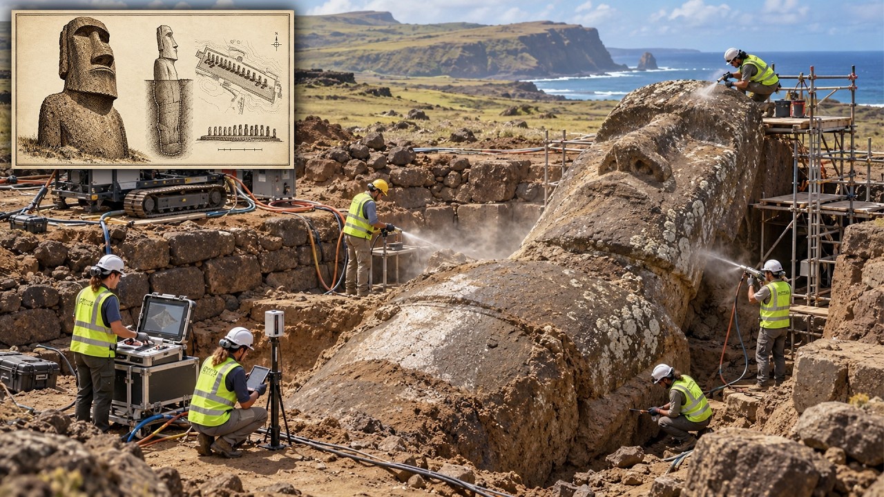
The features archaeologists had struggled to recognize from the ground—trenches, empty cavities where completed statues had been cut out, unfinished figures still attached to the mountain, anchor points, previously undocumented quarrying areas—suddenly appeared as a pattern. Thirty separate working areas, divided by unworked rock and natural boundaries, each containing its own mixture of extraction scars, unfinished statues, and production evidence. The number sounds almost trivial. Thirty workshops.
So what? But the researchers were suggesting something much larger than a new inventory of ancient workspaces. They were suggesting that the most famous monumental tradition in the Pacific may not have been built under the direction of a powerful centralized authority at all. And they were not alone.
In the previous year, two other major studies had begun dismantling the familiar story of Easter Island from entirely different directions. One used satellite imagery and machine learning to estimate how much of the island had actually been devoted to intensive rock gardening. Another examined the genomes of 15 ancient Rapanui individuals and looked for the genetic signature of a catastrophic population crash that supposedly occurred before Europeans arrived. The agricultural evidence pointed toward a smaller population than many older models assumed.
The genetic evidence found no sign of the severe 17th-century bottleneck required by the classic collapse story. Three very different forms of evidence were pointing in an unexpectedly similar direction. The strange part was not that archaeologists had discovered one new object on Easter Island. They were discovering a different island.
To understand why 30 quarrying areas matter, you have to begin with where Rapanui is, because nothing about this place is ordinary. The island is only about 164 square kilometers of land sitting in the southeastern Pacific, more than 3,500 kilometers from continental South America and over 2,000 kilometers from the nearest inhabited island. Polynesian navigators reached it centuries before European ships appeared, with most archaeological evidence placing permanent settlement around the 13th century. A voyaging community reached one of the most remote pieces of habitable land on Earth without modern navigation, established farms, developed settlements, learned the limits of a volcanic landscape, and eventually created one of the most recognizable monumental traditions humans have ever produced.
When Europeans finally encountered Rapanui in 1722, they were not seeing the beginning of the story. They were arriving extremely late. The monuments were already everywhere. Moai stood on ceremonial platforms known as ahu, many positioned around the island’s coast and generally facing inland toward the communities associated with them.
Their meanings varied across time and place, but they were deeply connected to ancestry, authority, memory, and the living communities that created them. Some wore enormous redstone pukao on their heads. Some once had coral and stone eyes. Though the statues vary considerably, they share a recognizable tradition: elongated heads, powerful torsos, carefully shaped facial features, and a monumental presence that becomes difficult to appreciate until you stand beside one.
The word “heads” has always been misleading. Many moai have complete bodies. Some were buried gradually by sediment around Rano Raraku, leaving only their upper portions visible. Rano Raraku is where the story becomes much more interesting.
Most moai were carved from volcanic tuff exposed within and around this crater. Hundreds of figures remain there in different stages of production. Some appear almost ready to leave the quarry. Others are only partly defined in the bedrock.
Some were abandoned before they were completely separated from the rock beneath them. Walking through the quarry is almost like walking through an ancient industrial site that stopped in the middle of a working day. You can see successful statues, failed statues, outlines, cuts, extraction scars, and empty cavities where completed figures once existed. Archaeologists are not looking at a finished monument here.
They are looking at the manufacturing process itself, frozen across the landscape. That has always created a huge question. Who organized all of this? Monumental construction often pushes archaeologists toward hierarchy.
If a society can quarry enormous blocks of stone, coordinate labor, produce standardized monuments, and transport them over considerable distances, it is tempting to imagine powerful rulers commanding large workforces. Think of ancient Egypt and royal building projects. So when earlier researchers looked at Rapanui’s astonishing investment in statue construction, it was easy to imagine a similar structure: elites controlling labor, specialists working within an organized production system, and perhaps an island-wide authority directing access to the critical quarry at Rano Raraku. But there has always been a problem with that picture.
Other evidence from Rapanui does not fit comfortably with a single centralized state. Historic accounts and archaeological patterns describe an island divided among kin-based communities, often associated with separate territories and ceremonial centers. Settlement remains cluster locally. Tool distributions can be highly regional.
Monumental platforms are repeated around the island rather than concentrated in one overwhelming political capital. Cultural similarities across the island coexist with considerable local autonomy. If that was how ordinary communities were organized, then what happened when everyone needed access to the same statue quarry? This is where the new three-dimensional mapping becomes so important.
The method, called structure-from-motion photogrammetry, is easier to understand than its name suggests. If you photograph the same rock from several different positions, the apparent position of features shifts slightly between photographs. Software can use those shifts to calculate depth and shape. Do that with thousands of high-resolution images and the result is a measurable digital version of the landscape.
The resulting model captures details on the order of centimeters. A digital model cannot identify a clan, read anyone’s thoughts, or tell archaeologists exactly when every cut in the rock was made. But it does something human eyesight is surprisingly bad at doing across a complicated landscape: it allows researchers to see spatial relationships consistently. A trench that seems isolated while standing beside it can suddenly line up with another feature 20 meters away.
Empty quarry scars can be measured against unfinished statues. Natural boundaries become visible. Repeated production zones can be mapped. Once researchers began doing this across the entire quarry, the landscape stopped looking like one enormous coordinated factory.
They documented 426 features representing moai in different stages of production, 341 trenches cut into the stone, 133 voids where statues had apparently been successfully removed, and five large features interpreted as possible anchor points connected with lowering statues down steep terrain. More importantly, those features were not arranged as one standardized production line. The quarry may have functioned less like a royal factory and more like a landscape occupied simultaneously by multiple working groups. That changes the question completely.
Instead of asking how a powerful ruler persuaded thousands of people to build statues, we may need to ask how relatively small communities independently produced monuments while sharing techniques, beliefs, and access to the same sacred resource. Those are very different social systems. One depends heavily on command. The other depends on negotiation, competition, cooperation, and tradition.
The moai can look standardized from a distance, yet the quarry contains evidence of variation in how they were produced. Researchers identified at least three carving approaches. In many cases, facial details were established before the complete outline of the statue. Elsewhere, carvers first defined a larger block.
On nearly vertical surfaces, some figures were worked sideways into the cliff. Variation does not automatically prove political independence—a centralized society can contain different craftsmen using different methods—but what makes Rano Raraku unusual is the combination of procedural variation, physically distinct production areas, and repeated sets of the same basic activities occurring across different parts of the quarry. There is no obvious central workshop dominating every other operation. There is no clear archaeological sign that one authority monopolized access to the stone.
Instead, the quarry looks increasingly compatible with multiple groups working beside one another, producing broadly similar monuments while retaining some freedom over how they did it. Even the number of people needed to work on an individual statue may have been smaller than the popular image suggests. Physical space around a partly carved moai severely limits how many people could actually strike the stone at once. The recent quarry researchers estimated that perhaps four to six carvers might work directly on a statue, accompanied by a larger supporting group preparing tools, ropes, food, and other materials.
That still represents serious organization, but it is not necessarily the organization of a king commanding an enormous labor force. A large extended family or community could potentially manage much of the process. Transport has undergone a similar rethink. For generations, the movement of the moai seemed almost impossible without huge numbers of workers, wooden rollers, or elaborate lost technology.
Yet experimental archaeology has demonstrated that upright replicas can be moved using ropes by coordinated teams rocking the statue from side to side and forward. The result looks uncannily like the figure is walking. Rapanui oral traditions themselves describe the statues as having walked to their destinations. That does not prove every moai was transported by exactly the same technique, and damaged statues found along ancient roads continue to raise questions.
But the experiment shows something crucial: monumental transportation did not necessarily require thousands of people or enormous quantities of timber. Suddenly, one of the apparent contradictions of Rapanui becomes less contradictory. A relatively small population could produce impressive monuments. Small communities could compete without requiring a centralized kingdom.
Shared religious traditions could generate broadly similar statues while local groups maintained distinct territories. Monumentality does not automatically equal state power. That may sound like a technical archaeological point, but it has consequences for the entire story of the island, because older collapse narratives often imagined an enormous population mobilized into increasingly extravagant monument building until the economy and environment could no longer sustain it. The agriculture evidence now complicates that image as well.
Rapanui is not an easy farming environment. Rainfall can vary. Soils are often nutrient-poor. Permanent surface fresh water is limited.
The islanders responded with techniques adapted to those constraints. One of the most important was lithic mulching, usually described as rock gardening. Farmers deliberately placed or broke rock across cultivated areas. The stones could reduce evaporation, alter soil temperature, protect surfaces from wind and erosion, and gradually release minerals as they weathered.
Sweet potatoes were especially important, along with other crops and marine foods. From the ground, however, ancient rock gardens can be difficult to distinguish from naturally rocky volcanic terrain. That matters because estimates of how much land was under intensive cultivation have been used to estimate how many people the island could support. If enormous areas were rock gardens, perhaps Rapanui once supported 15,000 people or more.
If the gardens were far less extensive, those population estimates become difficult to defend. In 2024, researchers applied shortwave infrared satellite imagery and machine learning classification to the problem. Different minerals, soils, vegetation, and moisture conditions interact with infrared wavelengths differently, allowing the researchers to distinguish archaeological cultivation areas from some natural features that appear deceptively similar in ordinary images. After manually checking the model output, they identified roughly 0.
76 square kilometers of surviving rock gardens. That is only about one-fifth of even the more conservative estimates used in some earlier studies. That does not mean every ancient garden has survived. Modern construction and agriculture have disturbed portions of the island, and small cultivation areas can escape remote detection.
Nor does it tell us the complete population size, because Rapanui people also consumed marine foods and cultivated crops outside intensive rock gardens. The researchers emphasized those limitations, but the finding makes the enormous population numbers required by some collapse scenarios considerably harder to support. Using the revised cultivation estimates, their models suggested that rock gardening alone could not have supported anything close to the highest proposed population figures. Under their most productive assumptions, the calculated maximum supported by the mapped rock gardens was under 4,000 people.
When other foods are considered, the real carrying capacity could have been higher, and nobody can currently give an exact pre-European population. Then came the ancient DNA. Researchers analyzed genome-wide data from 15 Rapanui individuals whose remains had been removed from the island and held in a European museum collection. The individuals dated to after the period in which the supposed pre-European collapse should have occurred.
That made their DNA potentially useful for asking a very specific question: a severe population crash leaves genetic consequences. When a population suddenly becomes much smaller, genetic diversity is lost in patterns that can sometimes be reconstructed centuries later. If Rapanui had experienced the kind of enormous 17th-century population collapse described in the classic ecocide narrative, researchers expected to detect evidence compatible with that bottleneck. They did not.
Their demographic models instead supported a population whose effective size remained relatively small and generally increased after the island was settled, without the dramatic pre-European crash required by the strongest versions of the ecocide theory. Genetic models are not time machines, and the researchers did not claim their results could tell us everything about ecological change. DNA cannot determine exactly how many palms were cut down, whether a local famine occurred, or how often communities fought. What it can do is test whether the genomes are consistent with certain demographic scenarios.
Hidden inside those same genomes was another surprise. All 15 individuals carried Native American ancestry—roughly 10% on average—and genetic dating placed the admixture event somewhere around 1250 to 1430. That is before European arrival on Rapanui in 1722, and before Columbus reached the Americas in 1492. The genetics therefore support some form of pre-European contact between Polynesians and Native Americans.
What they do not tell us is exactly where that contact occurred. Did Rapanui or other Polynesian voyagers reach South America and return? Did Native Americans travel westward into Polynesia? Did contact occur somewhere else in the eastern Pacific before ancestry reached Rapanui?
The genomes establish a connection more confidently than they establish the route. Think about what that does to the old image of Rapanui. The traditional collapse story sometimes imagined the islanders becoming trapped when timber disappeared, their seafaring ability destroyed, and their society increasingly isolated. Yet the genetic evidence belongs to a much wider Pacific story in which Polynesian navigators were moving across astonishing distances, and contact with people from the Americas occurred centuries before Europeans crossed the Pacific.
The exact voyage remains unknown, but the ancestry is real. Rapanui begins looking less like a civilization that immediately stranded itself and more like one expression of the most extraordinary expansion of human navigation before the modern age. There is another detail at Rano Raraku that complicates the idea that statue making was merely a destructive drain on resources. Excavations within the quarry have revealed unusually fertile soils and evidence connected with cultivation.
Quarrying volcanic tuff constantly broke fresh rock into fragments that could weather into mineral-rich sediment. The area around the statues was not simply an industrial wasteland where food production had been sacrificed to monument building. At least parts of the quarry landscape appear to have supported productive agriculture. Researchers have even recovered evidence associated with crops such as banana, taro, and sweet potato.
The familiar story encourages us to separate statues from survival. Every moai becomes another expensive project, consuming labor that should have been devoted to food, another symbol of leaders pushing society closer to catastrophe. But the archaeology keeps refusing that simple division. Quarrying changed soils.
Farming existed around monument production. Small kin groups may have been able to organize carving without a huge bureaucracy. Statue transport may have required dozens of people rather than thousands. The very evidence that once looked like proof of unsustainable excess begins, from another angle, to look like part of a flexible social system.
None of this means Rapanui was an ecological paradise. Pollen records show that the island was once far more heavily forested, including extensive populations of a now-extinct large palm. And by the time Europeans arrived, the landscape had changed radically. Humans certainly affected that environment.
Polynesian rats introduced with settlement probably played a role by consuming palm seeds, while land clearance, burning, and human use of vegetation also mattered, though the exact contributions remain debated. The important distinction is between environmental transformation and demographic collapse. A society can dramatically alter its environment without instantly destroying itself. On Rapanui, current evidence increasingly suggests that people adapted to the transformed landscape rather than simply disappearing because of it.
That distinction becomes especially important when we ask when the truly devastating population collapse occurred. Europeans reached Rapanui in 1722. Later encounters brought increasing disruption, violence, and exposure to diseases. During the 19th century, Peruvian slave raiders carried away large numbers of Rapanui people, including individuals who held important cultural knowledge.
Returning captives helped introduce disease. Epidemics followed. Missionary activity and outside economic control transformed life on the island further. By the 1870s, the surviving Rapanui population had fallen to little more than 100 people.
There was a catastrophic collapse on Rapanui. That part is not a myth. But increasingly, archaeologists and geneticists are questioning whether the famous collapse happened at the time and for the reasons popular culture has so often claimed. If the population remained relatively stable until sustained outside contact, then the story is no longer primarily about an isolated people destroying themselves.
It becomes partly a story about resilience under severe environmental constraints, followed by demographic catastrophe during colonial intrusion, slave raiding, and introduced disease. That is also why modern archaeology on Rapanui cannot be separated completely from the living Rapanui community. These are not anonymous ruins belonging to a vanished civilization. Descendants remain on the island.
Ancestors and cultural objects were removed into foreign collections during the 19th and 20th centuries, and repatriation efforts continue. In July 2026, the Australian Museum formally returned 17 ancestral individuals, along with a sample of human hair, to a Rapanui delegation more than a century after the remains had been taken from sacred contexts. The ancient DNA study itself was carried out in consultation with Rapanui representatives and emphasized the relationship between genomic research and repatriation. The people being studied are not a mysterious extinct race.
They have descendants. And that brings us back to those 30 production areas at Rano Raraku. Imagine standing above the crater while different groups work below. In one area, a small team begins outlining a statue directly into the volcanic rock.
Elsewhere, another group is already cutting beneath a nearly completed figure. Tools strike stone. Food arrives from nearby cultivated areas. Rope is prepared.
People exchange information. Families compete. Techniques differ slightly. Yet everyone recognizes the same basic monumental tradition.
There may have been rivalries, alliances, ceremonies, and negotiations that archaeology can no longer reconstruct. What survives is the organization written into the mountain. The discovery is not that archaeologists found a secret moai nobody knew existed, although previously undocumented quarry features were identified. The more important discovery is a pattern: 30 repeated production zones, multiple techniques, small-scale working spaces, transport infrastructure compatible with limited crews.
That pattern suggests that the monumentality of Rapanui may have emerged from decentralized communities rather than from an island-wide ruling elite. And if that interpretation continues to hold up, it changes how we understand one of the central questions raised by the statues. How can a small society create something enormous? For much of archaeological history, large monuments were treated almost as fingerprints of hierarchy.
Big construction seemed to require big authority. Somebody had to command. Somebody had to control surplus food. Somebody had to organize specialists.
Rapanui offers a different possibility. Complex projects can emerge through networks of communities that compete and cooperate without surrendering all authority to a single ruler. Shared culture can create standardization even when production remains local. Monumentality can grow horizontally as well as vertically.
There are still serious unanswered questions. We do not know the island’s maximum population with precision. We do not know exactly how political authority operated within each community or how access to Rano Raraku was negotiated. We cannot yet reconstruct the precise voyage that produced Native American ancestry in Rapanui genomes.
We still debate the speed and causes of deforestation. We do not know whether every moai traveled using the same transportation method. We cannot explain exactly why particular statues were abandoned or why monumental production changed. Even the 30 quarrying areas raise questions.
Were certain areas inherited by particular clans? Did groups work simultaneously for centuries, or did access shift over generations? Were some workshops more prestigious than others? The old version gave Rapanui a simple trajectory: people arrive, population explodes, forest disappears, statues consume resources, society collapses, Europeans find the ruins.
It is memorable because every event points in one direction. The archaeology we have now is messier. People arrive and transform the environment, but also invent agricultural adaptations. Communities build enormous monuments, but may do so without centralized rule.
Forests disappear, but the population does not show the expected genetic crash. An isolated island maintains evidence of contact with Native Americans thousands of kilometers away. Then outside contact introduces a new series of disasters that produce the clearest demographic collapse in the record. More than 11,000 drone photographs, each taken from a slightly different angle and each individually ordinary—a slope, a trench, a patch of volcanic rock, an unfinished face.
But when the images are combined, relationships appear that cannot be seen clearly while standing on the ground. In a strange way, that is exactly what has happened to Rapanui archaeology itself. For decades, individual pieces of evidence were interpreted through a powerful story about collapse. Now, genetics, agriculture, quarry mapping, experimentation, and historical records are being combined, and a different pattern is appearing.
It is not a story of people who mysteriously failed to understand the limits of their own island. It looks increasingly like the story of communities that understood those limits extremely well, because they had no choice. They engineered soils. They harvested the sea.
They coordinated labor. They carved ancestors out of a volcanic crater. They moved multi-ton statues across rough ground. They maintained cultural connections across separate communities.
And somewhere in their history, either they or closely connected Polynesian voyagers crossed enough ocean to leave Native American ancestry in their descendants. The real mystery of Easter Island was never how supposedly primitive people could carve giant heads. That question says more about modern assumptions than it does about Rapanui. The harder question is how a relatively small population living on one of the most isolated and environmentally constrained islands on Earth built a durable society capable of producing more than a thousand monumental sculptures while adapting continuously to a changing landscape.
The newest discoveries do not make that achievement easier to explain. They make it more impressive. For years, Rapanui was presented as archaeology’s most famous cautionary tale about collapse. Now it is becoming something much harder to summarize: a case study in resilience, adaptation, competition, cooperation, environmental transformation, and survival.
There are still arguments to settle and discoveries to make. There probably always will be. But the next time you see the moai standing silently above the coast, remember that the statues are only the most visible part of the archaeological record.
The really surprising discovery may be the society hidden in the spaces between them.
