The pilot had been told to hold his altitude and keep his speed low, and nothing more. The men in the back of the aircraft refused to explain what the equipment was for, offering only that it had cost more than the airplane itself, and that if he drifted even a few meters off course they would have to do the whole survey again. He flew back and forth over a stretch of lowland forest in Bolivia that looked from the window like any other stretch of Bolivian forest he had ever flown over. Trees.
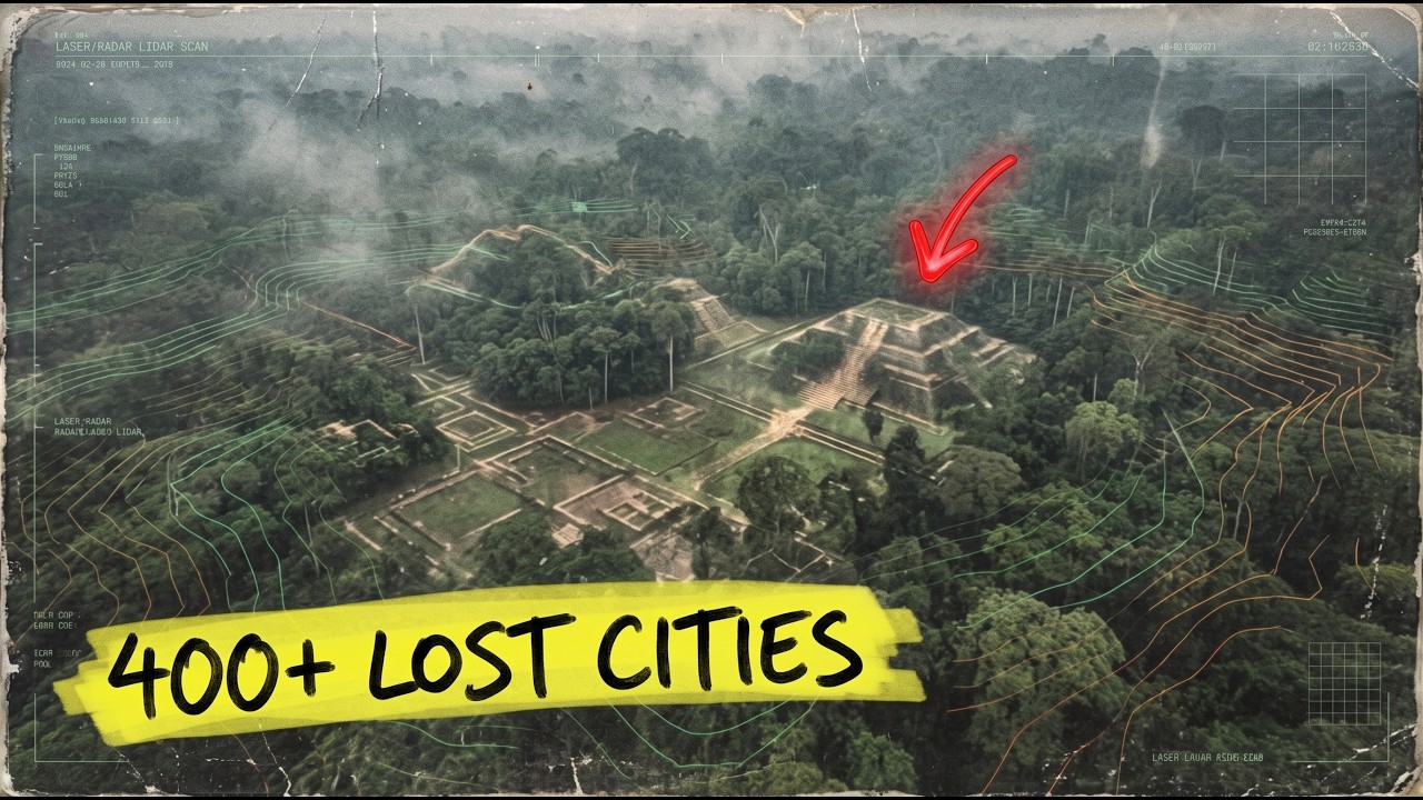
More trees. A brown river winding between the trees. Nothing visible from a thousand feet. Nothing seen from any altitude for more than five hundred years.
But what the equipment recorded was something else entirely. When the data came back processed, there were pyramids down there. Pyramids and causeways and reservoirs and canals, and a ring of subsidiary settlements arranged around a central platform in a geometric pattern that ran for miles beneath the canopy. The pilot had flown over a city.
He had not seen it, because no one who had ever flown over that patch of jungle, since the collapse of the civilization that built it, had been able to see it. And when the archaeologists who commissioned the flight published what they had found, the entire official story of the Amazon forest, the one taught in every anthropology department on earth for nearly a century, became unsustainable in a single afternoon. The technique is called lidar, light detection and ranging. A pulsed laser array mounted in the belly of a low-flying aircraft fires hundreds of thousands of pulses a second at the ground.
Most of the pulses bounce off leaves and branches and never reach the forest floor. But a small fraction slip through the gaps, strike earth or stone, and return. The returning signals are timed to nanosecond precision. When the computer stitches them together and strips away everything the vegetation was hiding, what remains is the true terrain below.
Every mound, every ditch, every road, every earthen rampart any human being ever dug into that soil. The forest becomes transparent. The last five hundred years of accumulated growth turn into a sheet of tracing paper the laser simply passes through as though it were not there. And what the Amazon canopy had been hiding, for a very specific reason, for five specific centuries, is not what any textbook will tell you was there.
For nearly a hundred years, the standard answer to the question of what lived in the Amazon before the Europeans arrived was: almost nothing. A few scattered villages, small bands of hunter-gatherers moving between fishing camps along the main river. No cities. No large-scale agriculture.
No monumental architecture. No political organization beyond the level of a tribal chief and his relatives. The soil was too poor for farming, the rains too heavy for building, the insects too numerous, the fevers too deadly. The Amazon was a green hell in which civilization could not take root.
This was the thesis, and it had a name, a face, and an institution behind it. Its most prominent champion was an American archaeologist named Betty Meggers, who worked at the Smithsonian Institution from the late 1940s until her death in 2012. She described the rainforest as a counterfeit paradise, luxuriant on the surface, barren at its core. In 1954 she published a paper arguing that the ecological limits of the tropics made any complex society there impossible.
The soils lacked minerals because of the rains, the growing season was deceptive, and the carrying capacity of any part of the forest was a fraction of what it appeared to be. She extended that argument across her entire career, and the field of archaeology followed her. By the 1970s, the counterfeit paradise model was the reigning doctrine. Every graduate program in New World archaeology taught it.
Every popular book about the Amazon repeated it. Every natural history museum exhibit in the hemisphere assumed it. The Amazon was a wilderness that had always been a wilderness. The tribes that lived there were remnants of a kind of eternal present, people who had never built anything larger than themselves because the land itself would not allow it.
That was the lesson in every textbook. It is still the lesson in some of them. And it was wrong to a degree no one during Meggers’s lifetime wanted to take seriously, because taking it seriously meant admitting that the first Europeans who descended the Amazon had been telling the truth. And the first Europeans who traveled the Amazon had been dismissed as liars for four hundred years.
In the summer of 1542, a Spanish expedition under Francisco de Orellana descended the Amazon River from the eastern slopes of the Andes all the way to the Atlantic. It was the first European voyage to traverse the length of the continent. The expedition’s chronicler was a Dominican friar named Gaspar de Carvajal, and his diary became one of the most disputed documents in the history of early American contact. Carvajal described a river lined with cities.
Not villages, not fishing camps, but cities. Towns stretching for miles along the banks, one after another, with roads running inland away from the water, surrounded by cultivated fields that extended as far as his eye could see from the boat. He described a continuous settlement running, by his count, for fifteen miles along the river. He described warriors massed on the banks in numbers that made his men afraid to land.
He described pottery as fine as anything in Málaga, polished and decorated in colors that reminded him of Moorish craftsmanship. He described roads wide enough for armies, running at right angles from the river into the forest. He described populations in the hundreds of thousands. For four hundred years, every historian who read Carvajal’s account concluded that he was making it up.
Carvajal’s Amazon did not exist in the Amazon visited by European explorers from the eighteenth century onward. Something had happened in the two centuries between Orellana and the next systematic voyage down the river, and no one could explain what. Because no one could explain it, the simplest reading was that Carvajal had invented the whole thing. His account was reclassified in historiography as fiction rather than historical document.
His description of warrior women on the lower river is what gave the Amazon its name, drawn from Greek myth, and the name itself was treated as proof of his falsehood. If the warriors were a myth, the cities probably were too. By Meggers’s era, Carvajal was a cautionary tale about the unreliability of first-contact accounts. The expedition went down the river, there were some people on the banks, and the friar had read too much classical literature.
That was the official reading. In the Bolivian province of Beni lies a region called the Llanos de Moxos, a seasonally flooded savanna the size of the state of Illinois, threaded by the headwaters of the Amazon drainage. For most of the twentieth century, it was described in the archaeological literature as a marginal land that had never supported anything of importance. In 2019, a team led by the German archaeologist Heiko Prümers of the German Archaeological Institute conducted lidar surveys over six sites in the Llanos de Moxos.
In May 2022 they published their results in Nature. What they found rewrote the pre-Columbian history of South America in a single paper. The Casarabe culture, which flourished from roughly 500 to 1400 CE, had built a network of urban centers connected by raised causeways. Two of its sites, called Cotoca and Landívar, were anchored by stepped platforms twenty-two meters high.
Pyramids. Tiered earthen structures with ceremonial plazas on their flat summits. Around them ran concentric moats and defensive walls. From the platforms, raised causeways radiated for miles across the savanna, straight as surveyor’s lines.
Reservoirs had been dug to store floodwater in the rainy season. Canals had been cut to drain it in the dry season. Smaller subsidiary settlements were arranged in geometric patterns connecting to the central platforms like beads on a string. The scale was urban.
The organization was state-level. And it had been sitting under an ordinary stretch of Bolivian lowland for a thousand years while every New World archaeology textbook in print insisted that nothing of the kind had ever existed anywhere in the Amazon basin. If the Casarabe culture had shaken the Meggers thesis, the Upano Valley shattered it. In January 2024, a team led by the French archaeologist Stéphen Rostain of the French National Centre for Scientific Research published results in Science that pushed the timeline back by two thousand years.
The site lies on the eastern slopes of the Ecuadorian Andes at the headwaters of the Amazon basin, in a river valley mainstream archaeology had never seriously studied because nothing of importance had ever been found there. Rostain had worked in the region for twenty-five years. He suspected something was there. In 2015, a lidar survey of a 300-square-kilometer area produced an image that made everyone in the room fall silent when his team first opened the file.
Beneath the forest lay six thousand earthen platforms, more than fifteen urban centers, and geometrically divided agricultural fields covering an area larger than present-day Manhattan. A network of straight roads cut the landscape with surveyor’s precision, some running twenty kilometers, intersecting at right angles in a grid pattern that would have been unremarkable in a Roman colony but was impossible in an Amazon that was supposed never to have advanced beyond the scale of villages. Carbon dating placed the oldest structures at around 500 BCE. The civilization flourished for more than a thousand years before collapsing, possibly due to the repeated eruptions of the Sangay volcano that overlooks the valley.
It was contemporary with classical Athens. It was urbanized before the founding of the Roman Republic. And it was built in a part of South America that mainstream archaeology, up to a week before Rostain’s paper was published, had considered incapable of supporting anything of the kind. Decades before any laser was pointed at any canopy, there was a man telling anyone who would listen that those civilizations were there.
His name was Percy Fawcett, a British Army colonel and surveyor who mapped the borderlands between Bolivia and Brazil for the Royal Geographical Society between 1906 and 1924. On his expeditions he saw things in the bush that his colleagues at the Society did not want to publish. Raised causeways covered in vegetation stretching for miles through forest where nothing should ever have been built. Pottery shards in soil that was officially virgin.
Indigenous people in remote villages told him their ancestors had lived in a city of stone they called by a name he recorded in his notebooks with the letter Z, and they said it lay east, deep in the Mato Grosso, in a spot no European had ever entered. In April 1925, Fawcett set out from Cuiabá, Brazil, accompanied by his son Jack and his son’s friend Raleigh Rimell. He was fifty-seven years old. He told his wife that if he had not returned within two years, no rescue party should come looking for him, because the forest would already have settled his fate.
He was last seen alive at a place he marked on his own map as Dead Horse Camp, on May 29, 1925. He vanished. His son vanished. Rimell vanished.
Over the following decades, more than a hundred people died trying to find them. Expeditions set out from England, from America, from Brazil itself. Every one failed. Fawcett was never found.
He was written off as a deluded man. The archaeological establishment of his era treated his belief in a lost Amazonian civilization as evidence of a mind unhinged by too many years in the field. Most twentieth-century exploration encyclopedias implied in their entries on him that he had gone mad. His theories about the ancient inhabitants of the interior were filed alongside spiritualism and lost-continent speculation.
In January 2024, Rostain’s paper on the Upano Valley was published, in a location four hundred miles northwest of the region Fawcett had been heading for when he disappeared. The urban structures revealed by Rostain’s lasers matched the descriptions Fawcett’s indigenous informants had given him almost exactly. Raised earthen platforms, wide straight roads, population centers of thousands, continuous settlement across a thousand years. Fawcett had not been deluded.
He had been a hundred years ahead of his time. The forest had not killed him because he was wrong. It had killed him because he was right, in a decade when being right was enough to end the career of any anthropologist older than he was on two continents. There was additional evidence that had been visible the whole century the counterfeit paradise thesis held sway.
The soil itself. Across the Amazon basin, in patches ranging from small plots to formations larger than small European countries, there is a soil locals call terra preta, black earth. It is anthropogenic. It did not form naturally.
It is the deliberate product of long-term human engineering. Charcoal mixed with pottery shards, animal bones, compost, and manure, applied to the forest floor layer after layer over centuries, possibly millennia. It is fertile where the surrounding soil is barren. It regenerates its fertility instead of depleting it when crops are grown in it.
Agronomists began studying it at the end of the twentieth century as a potential solution to tropical soil degradation worldwide. The work of the German soil scientist Bruno Glaser at the University of Bayreuth, published through the 2000s in journals such as Biology and Fertility of Soils, proved that terra preta contains nutrient levels three times higher than the surrounding native Amazonian soil, with a carbon content that remains stable across centuries instead of leaching out with the rain. These patches cover an estimated ten percent of the Amazon basin, possibly as much as twenty percent. The lower estimate alone represents an area roughly the size of France.
This is landscape-scale agricultural infrastructure that would have required coordinated labor across generations, planned at a civilizational level, and applied across a region the size of half the continental United States. It could not have been produced by a few scattered villages. The soil itself is testimony that something larger lived in the Amazon than mainstream archaeology was willing to accept. And terra preta had been documented, photographed, and published in soil science journals throughout the entire period Betty Meggers was arguing that the Amazon could not sustain a complex society.
It was in a different discipline. Archaeologists did not read soil science. Soil scientists did not read archaeology. The evidence stayed in two separate fields for forty years, and no one with authority in either field connected them.
Because connecting them would have required archaeology to admit it was wrong. Then there are the geoglyphs. In the Brazilian state of Acre, along the western edge of the Amazon basin, deforestation that began in the 1970s and accelerated through the 1990s began exposing something strange. As the trees fell, enormous geometric earthworks appeared beneath them.
Perfect circles, squares, octagons, compound shapes with interlocking concentric rings. Some measure three hundred meters across. The ditches forming them were up to eleven meters wide and three meters deep, cut into the laterite soil with a geometric precision that has no formal parallel in regional archaeology. So far more than 450 geoglyphs have been identified in Acre alone.
Satellite surveys suggest there may be ten times that many still hidden under the remaining forest cover across the wider basin. Carbon dating of material excavated from the ditches produced dates ranging from roughly 1250 BCE to about 1500 CE. The Brazilian geographer Alceu Ranzi, who began systematically cataloguing the sites in the 1980s after noticing the geometric forms in aerial photographs, has argued publicly that the geoglyphs represent the ceremonial infrastructure of a civilization that dominated an area larger than most European countries. The sites are oriented toward astronomical events.
They are too precise to be accidental and too large to be local. And they were invisible from the ground, which is why no one had ever reported them. Which is why the archaeology of the region was written for so long as though the land were empty. The only reason anyone sees them now is that the forest that hid them for a thousand years was cut down by soybean farmers and cattle ranchers.
No conspiracy was required for the concealment. The forest did the concealing. It simply grew back. Then there is Marajó, an island at the mouth of the Amazon the size of Switzerland.
In the 1940s and 1950s, it was the specific test case Betty Meggers used to anchor her counterfeit paradise argument. She excavated there and found what she interpreted as the ruins of a short, failed attempt at a complex society. Her reading of Marajó was that a small group had migrated from the Andes, tried to build an agricultural civilization on the floodplain, and collapsed within a few generations because Amazonian soil could not support them. Marajó became her model case.
The lesson drawn from it was that the tropics defeat everyone who tries to build in them. In the 1980s and 1990s, the American archaeologist Anna Roosevelt, working from the Field Museum in Chicago and later the University of Illinois at Chicago, returned to Marajó with better equipment, more systematic survey methods, and a willingness to reread the sites Meggers had dismissed. What she found rewrote the island’s history. The Marajoara culture had flourished continuously for more than a thousand years.
Its population at its peak numbered in the hundreds of thousands. The pottery Meggers had read as evidence of decline was in fact some of the most sophisticated ceramics in the pre-Columbian Americas, decorated with iconography of a complexity that implied a class of scribes or priests to maintain its traditions. The island had sustained a stratified society with its own art, its own ceremonial architecture, and trade networks reaching thousands of miles inland. Roosevelt published her results in a 1991 study titled Moundbuilders of the Amazon, to which Meggers responded with professional hostility for the rest of her career.
The dispute between the two women was the clearest crack in the counterfeit paradise consensus for about a decade before the lasers arrived to settle the matter in Roosevelt’s favor. In the Upper Xingu region of Brazil, the American anthropologist Michael Heckenberger spent three decades working alongside the Kuikuro people, descendants of the civilization his surveys were mapping. What he documented and published in multiple papers in Science and in his 2005 book The Ecology of Power was a network of at least nineteen interconnected towns, each with populations in the thousands, linked by roads up to fifty meters wide and designed on a recurring geometric plan spanning more than twenty thousand square kilometers. The region was urbanized at a density comparable to pre-industrial Europe.
Heckenberger called it a network of garden cities. His Kuikuro collaborators call it the land their ancestors engineered. When he asked them about the purpose of the walls and plazas, they answered simply, with no sense that the knowledge had been lost. The town he studied most intensively, called Kuhikugu, was continuously occupied from roughly 1500 CE until about 1600 CE.
Then everything stopped. The towns were abandoned. The agricultural infrastructure fell into ruin. The population collapsed to a tiny fraction of its former size.
There is no mystery about why. European pathogens reached the Amazon before the Europeans themselves, carried along the river systems by indigenous trade routes faster than any Spanish or Portuguese expedition. Smallpox, measles, influenza, and possibly hemorrhagic fevers swept through populations with no immunity. Historians now estimate that between eighty and ninety-five percent of the Amazon basin’s pre-contact population died within a century of first exposure.
The towns emptied. The agricultural systems failed. The forest, which had been pruned, planted, managed, and tended as a kind of continental garden for thousands of years, reclaimed everything within a few generations. By the time the next European expedition reached the river systematically, the civilization Carvajal had seen was gone.
And the Europeans who never saw it concluded it had never existed. All of that is the medieval-era story. The Casarabe cities, the Upano roads, the Xingu garden cities, the pyramids under Beni, the Acre geoglyphs. A civilization that was already dying when the Spanish arrived, and had vanished completely by the time the next survey parties came.
But there is an older layer beneath the medieval one, and it has its own set of impossible artifacts. They begin in a cave in the Brazilian state of Pará. The cave is called Caverna da Pedra Pintada, the Cave of the Painted Stone. It sits on a sandstone slope in the lower Amazon basin, its inner walls decorated with hundreds of red ochre handprints, geometric designs, and schematic paintings of what appear to be dancers and hunters.
Anna Roosevelt, the same archaeologist who had just dismantled Meggers’s readings of Marajó, excavated it in the early 1990s. In 1996 she published her results in Science. Hearths at the base of the deposits were radiocarbon-dated to about 11,200 BCE. That date was roughly two thousand years earlier than the prevailing model of the peopling of the Americas allowed for any humans in the Amazon basin.
It was a thousand years earlier than the Clovis culture, which had been the official chronological limit for human presence in North and South America throughout the twentieth century. It coincided with the end of the last ice age. It placed anatomically modern humans deep in the rainforest at a time when, according to every New World prehistory textbook, no one was there at all. Roosevelt’s dates were attacked for years by senior figures in the field.
Her findings have since been replicated by independent research teams. The occupation of Pedra Pintada is now accepted. What the timeline it imposes on everything that was supposed to have happened in the Amazon afterward remains unabsorbed by the textbooks that contradict it outright. If Pedra Pintada stretched the timeline, the next site stretched the limits of what anyone had imagined.
Along the Serranía de la Lindosa in Colombia’s Guaviare province, at the far headwaters of the western Amazon basin, runs a thirteen-kilometer sandstone cliff covered in tens of thousands of red ochre paintings. The site had been known to locals for generations. For most of the twentieth century it was inaccessible to outside researchers because the region was controlled by FARC rebels. After the 2016 peace accords, archaeologists finally gained access.
A team led by José Iriarte of the University of Exeter and the Colombian archaeologist Francisco Javier Aceituno published their first systematic survey in Quaternary International in 2020. What they found on those cliffs was a bestiary that should not have been there. Alongside handprints, geometric motifs, and dancing human figures, the ancient painters had rendered, in precise anatomical detail, giant ground sloths twenty feet tall, mastodons, native American horses, Pleistocene camelids, and a creature with a long trunk and three claws that Iriarte’s team identified as a giant armadillo of the genus Glyptodon. Every one of these is a species mainstream scholarship insists went extinct at the end of the last ice age, between 12,000 and 10,000 BCE.
That means the people who painted them saw them alive. That means humans were deep in the Amazon basin in sufficient numbers to produce massive, sustained rock art during an era mainstream archaeology classified as far too early for such a thing. The Lindosa cliff is a direct eyewitness document of a Pleistocene Amazon. It was painted by people whose descendants mainstream anthropologists were, until 2019, describing as recent migrants whose ancestors had barely arrived.
There is a detail that keeps drawing the eye back to the Prümers paper, the Rostain paper, and the maps of what has actually been surveyed. The Amazon basin covers nearly seven million square kilometers. The total area covered by lidar to date, including every published study, every academic project, every collaboration between international researchers and Brazilian, Bolivian, Peruvian, or Ecuadorian institutions, is less than half a percent of the total. The 450 Acre geoglyphs were revealed by deforestation, not by survey.
The Casarabe sites were found in six specific sectors deliberately chosen because ground surveys had already suggested something was there. The Upano Valley sites emerged from a 300-square-kilometer area of a basin more than twenty thousand times larger. What has been scanned is no more than a thumbprint. What remains under the vegetation is an entire continent.
In 2023, a joint team of researchers from the University of Florida and Brazil’s National Institute for Amazonian Research published an estimate of unsurveyed sites based on the density of known discoveries. Their model projections, published in Science, indicated that between ten thousand and twenty-four thousand pre-Columbian earthwork settlements remain undiscovered in the Amazon basin. That is a conservative estimate using conservative extrapolation methodology. The real number may be much higher.
Each of those sites may represent a town, a ceremonial center, a road hub, an agricultural complex. Each one was inhabited. Each one was part of a network linking it to the others. The Amazon was not empty.
It was teeming. And it was emptied so thoroughly in the century after 1492 that the forest grew back over it in two centuries, and the people who returned to study it could not see what had been there. The surviving native accounts of what had been there were classified as myth. None of what has been described here is hidden, secret, or hard to access.
Prümers’s paper is publicly available in Nature. Rostain’s is in Science. Heckenberger’s book is in print and widely cited. Carvajal’s diary was translated into English more than a century ago.
Terra preta research has been published in soil science journals for thirty years. The Acre geoglyph inventory has been in public records since the late 1980s. It is simply absent from the way most people understand what the Americas looked like before 1492. The gap between what is now known to lie beneath the forest and what is still told about what was there.
The lag between the data and the textbooks. How an entire century of entrenched belief collapses in a two-paragraph abstract in a journal most people do not subscribe to, in a field most people do not know exists. This is the pattern, and it is not unique to the Amazon. It is the shape every suppressed history takes when the suppression is not conspiratorial but institutional.
There was no central office that ordered the Amazon reclassified as empty land. There was a dominant researcher, a funded institution, and a thesis that became doctrine because the alternative required reconsidering every map, every textbook, every assumption about what human civilization could do and where it could do it. Once the thesis became institutionalized, the contrary evidence had to compete not only against the facts but against the careers built on the earlier reading. Carvajal was called a deluded man for four centuries.
Fawcett was called mad and then quietly killed in a jungle he had been right about. Terra preta stayed trapped in agriculture journals for decades before archaeology acknowledged it. The geoglyphs were literally chainsawed out of the forest before anyone in academia would look at the aerial photographs Alceu Ranzi had been showing them since 1988. Roosevelt was treated as a professional embarrassment by the woman whose thesis she had just disproven.
The Casarabe sites were six specific cities from a region the size of Illinois. The Upano Valley was 300 square kilometers of a basin thousands of times larger. The Amazon is just one data point. Apply the same logic anywhere.
What lies under the ice of Antarctica, under the dunes of the Sahara, under the waters that rose at the end of the last ice age, under the forests of Central Africa, the Congo, New Guinea, Borneo? The surveyed portion of each is minuscule. The institutional pressure to maintain existing timelines is immense. The careers that would end with a discovery the size of Rostain’s January 2024 publication number in the thousands across the discipline.
And the technology that will make the invisible visible — airborne lidar, satellite ground-penetrating radar, muon imaging, orbital synthetic aperture radar — is being used on a tiny fraction of the places it should be used to rewrite the true story of the human past. The dominant doctrine is not maintained by conspiracy. It is maintained by inertia, by the structure of funding, by the simple cost of an hour of flight time in a laser-equipped aircraft over a forest no one on a tenure committee is in a hurry to pay for. The ancient testimony, Carvajal’s river of cities, and the native memory passed to Fawcett in villages on the edge of the Mato Grosso.
The Kuikuro accounts of their ancestors’ towns that Heckenberger listened to when no one else would. They were accurate all along. It took satellites and lasers for official history to accept what local people had always said was true. And you have to ask what else they were right about.
Which other witnesses were called liars because they described a world that no longer matched the world Europeans found when they returned after a hundred years? Which other soils were anthropogenic? Which other continents were urban before they were depopulated? Which other maps we now call fiction were, in the lifetime of their makers, a plain record of what they saw with their own eyes?
The survey of the Amazon is still underway. New papers come out every eighteen months. Each one adds to the list of sites that were supposed not to exist. In early 2026, a team working in the Guiana Shield announced preliminary results of a survey revealing what appears to be a geometric settlement complex spanning the border between Suriname and northern Brazil.
The site has not yet been dated or formally named. The announcement was buried in a conference proceeding almost no one read. The lasers keep flying. The data keep coming.
Every new survey, somewhere in the basin, is another window quietly closing on the counterfeit paradise argument. What was down there? Who built it? How many lived there?
What did they know, what did they grow, what did they write, if they wrote, what stories did they tell about themselves and the gods they believed put them in that forest? What did they call the river we now call the Amazon, in the language of the civilization whose towns lined its banks for a thousand miles? All of it is still under the vegetation. The lasers see shapes.
The shapes are the outlines of a question we have only just begun to be able to ask. They are not the answer. Carvajal saw a river of cities. For four hundred years, we called him a liar.
The cities are now part of nature. The cities are now part of science. The cities are still, for the most part, invisible. The people who could have told us the truth about them are gone.
And the forest that grew over their bones made their silence the official history of an entire continent. The pilot flies over the canopy. Below, there is nothing but green. Until the laser array in the belly of the aircraft begins to pulse.
And then the ground beneath him stops being what he thought it was.