By the spring of 1945, German officers were discovering that the oldest rule of war had been turned against them. For centuries, the defender had enjoyed an advantage no invader could buy: he knew his own ground. The roads, the rivers, the folds of terrain passed down through generations—all of it belonged to him. Napoleon had shattered against a Russia he could never understand.
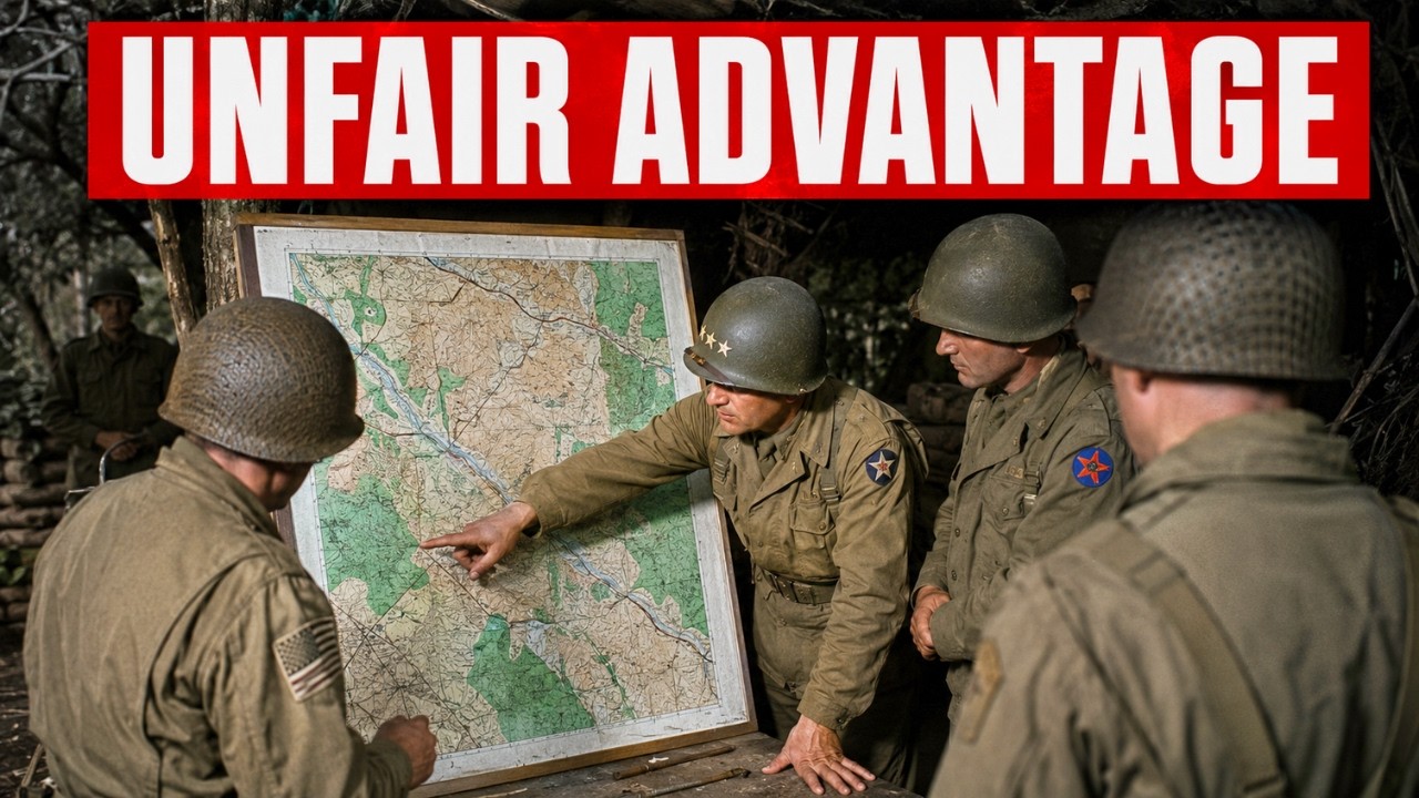
But now, inside their own borders, the Germans found American troops moving across Germany with maps of German territory that were more accurate and more current than anything the German army possessed. Men who examined those captured papers searched for a single word to describe it: unfair. How could a nation three thousand miles away know Germany better than the Germans themselves did? The answer begins in February 1943, with a catastrophe in the hills of central Tunisia.
The United States Army, as a map-making organization, was something close to a joke. It had the most industrialized economy on earth, yet its soldiers were fighting through terrain they could barely identify on paper. The men of the American II Corps were ordered to defend a line of ridges and passes along the eastern edge of the Western Dorsale, the mountains guarding the approaches to the Tunisian interior. The maps they carried were French colonial maps, many printed before the war at small scales with wide contour intervals.
Along the Mediterranean coast, French surveys were reasonably good. Inland, where the actual fighting was about to happen, they faded into optimistic approximations. A hill overlooking a valley might appear as a brown spot with numbers beside it. The contour interval was so coarse that a change in elevation of ten stories could vanish between two lines.
An officer ordered to occupy a certain hill could stand on the wrong one without knowing it. Above the bad maps sat bad leadership. The II Corps commander, Major General Lloyd Fredendall, kept his headquarters far behind the front in a ravine near Tebessa, never visited the forward positions, and issued orders in a strange personal language his subordinates sometimes struggled to decipher. His forces were scattered in small units across the terrain, none of them conducting reconnaissance.
When Field Marshal Erwin Rommel and German armored forces struck through the passes on 14 February, the American defenses collapsed. Over the following days, the II Corps was pushed back as far as fifty miles. American losses reached nearly six thousand men killed, wounded, and missing, along with large numbers of tanks, vehicles, and guns. The maps were not the only cause of what happened at Kasserine.
Inexperience, poor positioning, and Fredendall’s command failures contributed more. But the maps were part of the wound. Soldiers called for artillery fire on grid squares that did not match the ground, requested support toward roads that lay elsewhere, and retreated because of terrain that turned out to be a kilometer from where the map placed it. To understand why the richest nation in the war sent its men into battle half-blind, one has to understand what American military cartography actually was before 1942.
For the wider world, it barely existed. The United States had a respectable program for mapping its own territory, run by the Geological Survey and the Corps of Engineers, but it possessed nothing covering foreign countries. There were no repositories of detailed maps of Tunisia, Sicily, the coast of France, or the interior of Germany. An army that had spent the interwar years small, thinly funded, and focused on its own hemisphere had never been asked to picture the terrain of distant continents.
What filled the gap in those first campaigns were borrowed and improvised materials. The earliest map series issued to Mediterranean and North African theaters relied heavily on British maps produced by the Geographical Section of the General Staff, the cartographic arm of the British army that had been planning the Empire and its approaches for generations, supplemented by old French colonial surveys and corrected where possible by aerial photography. American troops went to war reading other people’s maps, patched together on the move. In the worst cases, they relied on whatever commercial product could be found.
The gap was not a failure of intelligence or courage. It was structural. A nation that had never built the machinery to see foreign ground could not invent it in a single season. The institution that would eventually close that gap had been created only months earlier.
In February 1943 it was still small. The Army Map Service was founded in 1942 by merging the Corps of Engineers’ map reproduction plant with the War Department’s cartographic section, bringing printing and compilation under one roof. Its headquarters was a facility in Brookmont, Maryland, outside Washington, descended from the copying plant that had served the army since the previous war. In peacetime it printed a modest number of military maps, a few hundred employees working in cramped quarters.
Nothing suggested it was about to become one of the decisive industrial institutions of the American war effort. What changed everything was defeat. The lesson absorbed from North Africa was that an army that cannot see the ground it fights over will keep losing men for reasons unrelated to courage. In the aftermath of the Tunisian fighting, the Army Map Service accelerated its expansion with new urgency.
Over the next two years it grew from a few hundred employees into round-the-clock operations in every theater of the war. That quiet, nearly invisible decision committed the United States to solving a problem no army had ever solved on an industrial scale. On the other side of the lines stood the organization the Americans were determined to surpass. German military cartography was old, deep, and respected.
It was administered through the Heeresplankammer, the army’s central map office, and a broader surveying and mapping directorate. German maps of foreign lands were often beautiful and precise, the product of a professional tradition that had spent decades perfecting its craft. In the 1930s, the Germans absorbed the survey records and cartographic offices of the countries they occupied, adding foreign data to their own. On paper in 1943, the German mapping establishment was the best in the world, and its officers believed it.
But the German system carried a weakness that would only show under the pressure of a long war. It was built on a peacetime model of map revision. Surveys were conducted, sheets compiled, printed, and revised at a slow pace suited to an established bureaucracy. The Germans did not conduct high-altitude reconnaissance flights over their own territory because there was no peacetime reason to photograph ground they already controlled.
Their maps recorded the world as it had been surveyed, not as it changed week to week. As long as the front stayed static, that was sufficient. Once the ground itself began to change faster than a peacetime office could redraw it, the whole edifice fell behind, with no fast way to catch up. The American problem was harder than simply printing more maps.
How do you map territory you are not allowed to enter? How do you chart the interior of a country actively trying to kill anyone who approaches, and do it faster than that country can change its terrain? The answer required more than draftsmen and presses. It required a means of seeing enemy ground from a distance, capturing it at sufficient accuracy to build a map, and converting that raw material into finished maps on a schedule measured in weeks, not years.
One piece of the answer was already taking shape in an unexpected place: the Office of Strategic Services, America’s wartime intelligence agency. Its map division, led by the geographer Arthur H. Robinson, grew to about 150 people and produced roughly five thousand maps for the war effort, including the situation maps used at the highest levels of Allied command. Robinson himself prepared and supervised cartographic materials for the major Allied conferences, including Cairo and Quebec.
Yet every map, no matter how brilliantly drawn, depended on data someone had to go out and collect. The ground the Americans most needed to see was under German control, defended by anti-aircraft guns and fighters flying thousands of feet below the only vehicles that could reach it. If the United States wanted to map enemy territory, someone would have to fly over it alone and come back with the picture. The scale of what North Africa demanded makes the starting point clearer.
The campaign as a whole ultimately required about a thousand different maps, of which nearly ten million copies were printed to supply troops in Morocco, Algeria, and Tunisia. That was staggering by pre-war army standards, yet small compared to what awaited. The heart of the technical problem was terrain accuracy: the representation of high and low ground. A tactical map depends on contour lines, the thin closed curves that tell a soldier whether he is climbing or descending and how steeply.
On the French maps in Tunisia, the contour interval was wide, meaning lines were spaced far apart in elevation. Commanders planning to move armor across what looked like gentle slope could discover the real incline was too steep, or that a hill identified as a single feature was actually two hills with a dead zone between them where the enemy could wait unseen. The machine that would answer this problem had four parts: the reconnaissance aircraft, the photo interpreter, the drafting room, and the printing press. The aircraft was a P-38 Lightning stripped of everything that made it a fighter.
In its photographic form it was designated F-5. Where a fighter carried machine guns and cannon in its nose, this carried cameras, usually arranged to look straight down and to both sides. The most demanding configuration was trimetrogon photography, developed in the United States, in which three cameras fired simultaneously—one pointed straight down, two angled outward—so that a single pass captured everything from horizon to horizon. The overlapping images could be assembled into continuous coverage of a strip of land miles wide, and from that overlap, interpreters could extract the third dimension: the elevations and slopes tactical maps required.
The pilot paid the price for that coverage. To produce images that matched properly, the aircraft had to fly straight and level on a constant course and altitude, often above twenty thousand feet, holding the line while the cameras worked. A fighter pilot under threat could turn, climb, dive, or take evasive maneuvers. A reconnaissance pilot on a photographic mission could not; once he strayed from the course, the images were useless and the mission lost.
The F-5 carried no defensive armament at all. Its protection was altitude, speed, and hope. Reconnaissance aircrews suffered some of the highest casualty rates among Allied pilots not flying bombers. They did it without firing a single shot.
The pilots’ images were only the beginning. A pile of overlapping aerial photographs is not a map. It is a collection of pictures taken from a moving aircraft, distorted by camera angle, aircraft tilt, and lens curvature, meaningless until someone measures them, interprets them, and converts them into lines on paper. That work happened at photo interpretation centers.
The largest and most important in Europe grew up in a country house called Danesfield in Medmenham, Buckinghamshire, England, where the Allied Central Interpretation Unit brought British and American interpreters under one roof. The operation grew with the war, from a few hundred to more than seventeen hundred staff working to sort and study the ever-increasing flood of imagery from reconnaissance flights over occupied Europe. Interpreters worked in stereoscopic vision, placing two overlapping images of the same area side by side and viewing them through instruments that fused the pair into a single three-dimensional image, hills rising from the print and valleys sinking below. Using plotting instruments that measured the displacement between the two images, they extracted elevations and contour lines with high accuracy.
On the American side, the same conversion from imagery to maps was carried out by Army topographic engineering units, specialized battalions deployed into theaters with plotting and reproduction equipment. By mid-war, the people doing this work were increasingly women, as male geographers and draftsmen were drafted into military service. The Army Map Service filled its drafting rooms with young women recruited from university programs, trained in intensive courses, and put to work at light tables. Within the organization they earned a nickname: the army map girls.
Kent State University in Ohio, in particular, sent a steady stream of geography students to the Army Map Service. By the last part of the war, women formed a majority of the Army Map Service workforce. The work itself was precise in ways easy to underestimate. A cartographer at a light table copied contour lines and detail from a compiled source onto a drawing surface using pens with lines finer than a hair, with a margin of error measured in fractions of a millimeter.
A slip of the pen moving a contour line slightly changed the apparent steepness of a slope. An inaccurately drawn road bend might send a tank platoon toward a rise it could not actually climb. What set the American effort apart from every other mapping establishment in the war was not the skill of any single draftswoman or the quality of any single sheet. It was the scale and industrial system that produced it.
Between 1941 and 1945, the Army Map Service prepared tens of thousands of different map titles and printed nearly five hundred million individual map sheets. The organization that employed a few hundred people in peacetime employed more than thirty-five hundred at its peak. Observers later calculated that if those five hundred million sheets were stacked, the pile would rise miles into the air. This was not craft in the old sense.
It was manufacturing—the same industrial logic that filled the seas with Liberty ships and the skies with bombers, turned to producing paper that could see. Against this, the German establishment could not match the pace. Its map office was built to review sheets based on surveys conducted at a leisurely peacetime rhythm. It did not conduct high-altitude aerial reconnaissance over territory it already controlled.
It had no rapid mechanism for recording changes on its own ground. It did not have an industrial assembly line running day and night at the American scale. The Germans could still produce beautiful, accurate maps of correctly surveyed terrain. What they could not do was update them at the speed of an army that photographed the ground from the air one week and printed corrected sheets the next.
All these capabilities converged during 1943 and 1944 into a single operation it was forbidden to name: the invasion of northwestern France. The Allied mapping program for the Normandy landings and the campaign that followed produced about three thousand different maps. The total number of individual sheets printed and shipped for the invasion and the fighting in Normandy was nearly seventy million copies. For a single operation, that number is difficult to comprehend.
It represented a deliberate decision that no soldier would set foot on contested ground without the most accurate possible picture of it that the system could produce. The most detailed assault sheets were drawn at large scales up to 1:12,500, close enough to show the individual features an assault force needed to see. Behind the maps lay a special intelligence problem of amphibious assault: the need to know the beach itself, not just the ground behind it. Planners had to know the slope of the sand at the waterline, whether the sand would bear the weight of a tank or swallow it, and what obstacles and mines the Germans had planted just beneath the surface.
Allied intelligence combined stereoscopic aerial photography with pre-war photographs and tourist postcards of the Normandy beaches, geological studies written by academics for entirely peaceful purposes, and, most directly, small teams that came at night in midget submarines and collapsible boats to the enemy shore, where swimmers went into the water to collect sand samples and measure the beach by hand. From all this, planners built a profile of the invasion coast accurate to the meter. The inherent limits of that machine were visible where its raw material ran short. At Peleliu in the Palau Islands, Marines landing in September 1944 found that pre-war maps of the island were poor and that aerial reconnaissance had failed to reveal the true nature of the terrain: a series of coral ridges riddled with caves that did not show clearly from the air.
The result was a battle far longer and more costly than planners had expected, fought across terrain the maps did not accurately describe. Once ground fighting reached Germany itself, the cameras could not photograph the accumulated survey records of the German state from twenty thousand feet. Seizing the network would require men on the ground moving into captured towns to seize the enemy’s own maps before they could be destroyed. That task fell to a small team following the front lines.
The man who would carry the paper advantage into German territory was a civil engineer named Floyd W. Hough, forty-six years old, a Cornell graduate who had spent his career surveying difficult terrain. He had run survey expeditions in the American West for the government and mapped terrain in South American forests for oil companies. By the time of the war, he headed the geodetic section of the Army Map Service.
Geodesy is the science of measuring the shape of the earth and fixing precise reference points on it—the invisible frame under every accurate map. Hough understood, more than almost anyone in American cartography, that the finished German map was only the surface of something deeper. Beneath it lay the survey network: the master framework of measured points on which German maps had been built over decades. If you captured the maps, you had maps.
If you captured the network, you could make better maps than the Germans could make themselves. Hough traveled to Europe in late 1944 at the head of a small special team, a mixed group of about nineteen men. They carried special passes from the Supreme Headquarters Allied Expeditionary Force permitting them to move with the advancing troops and enter captured cities before the normal occupation apparatus arrived. Their mission was urgent for a specific reason.
As the Reich collapsed, German survey records were being moved and hidden, and much of the country the Americans were advancing into would soon fall within the agreed Soviet occupation zone. Any cartographic treasure in central Germany had to be found and removed before its owners destroyed it or it was lost behind the line the Americans would not cross. Early attempts showed how narrow the time margins were. Aachen, the first major German city to fall, was captured in October 1944 after fighting left much of it in ruins.
When Hough’s men searched it, they found the survey records they wanted had already been moved out. The lesson was not failure but methodology: a team following the front closely could reach cartographic targets in any captured city within days. The German counteroffensive in the Ardennes in December 1944 put the entire western front on the defensive, and Hough’s work stalled with everyone else’s through the winter. Only when the front began to move again in early spring 1945 did the richest finds come.
At Wiesbaden, the team recovered bundles of survey data the German authorities had classified and hidden, covering thousands of reference points across the southwest of the country. Hough recognized immediately that this was not archival material for postwar study. It had immediate operational value because the Seventh Army was at that moment fighting across precisely that ground. Instead of sending the material back through slow intelligence channels, Hough pushed it forward to the artillerymen who needed it.
American artillery crossing into that part of Germany was directing its fire using a German survey system the German government had classified only weeks earlier, now being used against the army that had built it. The greatest prize still waited, and it was reached through interrogation rather than search. A captured officer from the German land survey office revealed that the most important classified cartographic material had been moved out of Berlin as the bombing intensified and hidden in small towns in the hill country of Thuringia, far to the east. Acting on that information, the team rushed to Saalfeld, where a central depot of the German army’s maps and survey holdings had been moved, arriving in mid-April 1945, days after the town fell to American forces.
What the men who catalogued the find later described as the greatest capture of its kind ever obtained from an enemy in wartime: the accumulated survey framework and map production of the German state. The material finally shipped to the Army Map Service amounted to ninety tons of maps and survey records, roughly one hundred thousand maps, along with the precision instruments that had made German mapping possible. The team also captured the men who understood that data. Among those taken into American captivity was Lieutenant General Gerlach Hemmerich, the senior official of the German surveying and mapping establishment—the man who had stood at the head of the very system the Americans had spent two years surpassing.
By that spring, the reversal was total. The German mapping system had effectively collapsed. Allied bombing had destroyed its printing capacity. Its central operations had been driven out of Berlin and scattered into hiding.
The man who ran it was either dead, captured, or working under American supervision. A German commander inside his own country in the final weeks of the war might wait in vain for an updated sheet for his sector, because the supply line that was supposed to produce it no longer worked. The captured German surveys did not disappear into a warehouse after the war. Hough arranged for German geodesists to continue their calculations under American supervision, merging the German reference network with Allied data.
From that work came a unified survey of central Europe, expanded in subsequent years into the European datum of 1950, which connected the continent in a single measurement and became part of the foundation for later Western and NATO mapping systems. Field Marshal Gerd von Rundstedt, who commanded German forces in the west, gave a frank explanation after the war of what had defeated him there. He cited the overwhelming superiority of Allied air power that made movement in daylight impossible, the fuel shortages that paralyzed his tanks, and the systematic destruction of the railways that meant he could not move his troops to where they were needed. Each of those factors was a form of the same thing the maps represented: an enemy who could see the battlefield, reach it, and organize it on a scale and at a pace Germany could not match.
The map was the quiet version of that superiority. It never exploded and never appeared in any official communiqué, and for that very reason it was the hardest for German generals to talk about afterward. It was easier to speak of air power and fuel than to admit that the enemy knew the ground better than the men defending it. Even before the fall of Germany, captured commanders were telling their interrogators that the Americans seemed often more familiar with local terrain than the German units that had held that ground for years.
That did not come from spies in every village. It came from the machine: reconnaissance aircraft, interpreters, drafting rooms, and map presses working in a sequence no other army had assembled. By the time the Americans stood inside Germany holding the Germans’ own surveys, the reversal had become a settled fact of the war, embodied in ninety tons of boxes headed for Washington.
The side that owned the ground had lost the oldest advantage of all.
