On the morning of June 25, 1958, a surveyor working for Ontario Hydro at the Moses-Saunders power dam site near Cornwall, Ontario, stood at the crest of the Long Sault control dam with a level and a rodman, taking water readings in the upstream pool. His instrument read 238. 4 feet above sea level. The target figure, written into the flooding plan by the engineers of the St.
Lawrence Seaway Authority, was 238. 0. He was four-tenths of a foot high. The pool was rising at exactly the rate the hydrological calculations had predicted, and in six days, on July 1, 1958, the dam gates would be set to their final operating position.
The new reservoir surface would be held at 238. 0 feet above sea level for the entire expected working life of the dam. The land behind the Long Sault dam that lay below 238. 0 feet was farmland, villages, and a river bottom that people had occupied since the eighteenth century.
It was the land of ten communities: Aultsville, Farran’s Point, Moulinette, Wales, Dickinson’s Landing, Maple Grove, Santa Cruz, Woodlands, and Iroquois. Iroquois was not flooded, only relocated, a distinction the people of Iroquois found meaningless when the thing being moved was the place your family had lived for six generations. The 6,500 people who lived in those communities had already been moved, under the authority of the Ontario Hydro Act and the agreements between the governments of Canada and the United States, the province of Ontario, and the state of New York that authorized the project. They were moved because the project required a pool, and the pool required land, and the land was expropriated according to appraisals set by Ontario Hydro.
The surveyor recorded the reading in his field book and made no comment. There was nothing to comment on. The water was behaving exactly as the engineers calculated it would. The communities behind the dam were gone in the sense that they would permanently disappear, the only sense that mattered to the people who had lived in them.
He is in the payroll records of Ontario Hydro, if those records still exist in an accessible form. His name is not in the Lost Villages Historical Society in Morrisburg, Ontario, which now holds the artifacts of the drowned communities. The men who drove the bulldozers that dropped condemned houses into burning piles before the flooding are not there either. The St.
Lawrence River runs 744 miles from the northeast corner of Lake Ontario to the Gulf of St. Lawrence on Canada’s Atlantic coast. It drains the Great Lakes basin, which holds roughly 21 percent of the world’s surface fresh water, and touches eight American states and two Canadian provinces. It passes through some of the most productive farmland in North America, and past some of the largest industrial cities the continent built during the age of heavy manufacturing.
It is the reason Montreal and Quebec City exist, and the reason European ships could reach the interior of the continent at all. It is also not navigable for ocean-going vessels along most of its length without human intervention. The river drops 246 feet in elevation between Lake Ontario and the sea. It loses part of that height through a series of rapids in the Canadian section between Prescott and Montreal, which defeated every attempt to move loaded ships upstream until the earliest St.
Lawrence canal builders began cutting routes around them in the 1780s. It loses the rest across the drop of the Great Lakes themselves, which are like a staircase, each lake higher than the next, joined by rivers and waterfalls that prevent any vessel of significant draft from passing between them without locks. Niagara Falls alone drops 167 feet. The falls are not navigable.
They have never been navigable. Anyone who wanted to move goods between Lake Ontario and Lake Erie without engineering had to move them overland or not at all. The commercial weight of that geography had hung over the American and Canadian interior since the first European traders understood what lay beyond the rivers. The fur trade came down the St.
Lawrence because there was no other practical route to the sea. The agricultural surplus of the Ohio Valley moved through the river systems to Montreal and Quebec and then to ocean ships, because there was no other way to move it in quantities that made farming economically viable. By the mid-nineteenth century the Great Lakes carried the bulk of the continent’s internal grain trade, and grain moving through Lakes Superior, Michigan, Huron, Erie, and Ontario traveled on freighters built for fresh water, constrained by the dimensions of the canal locks that existed when those ships were designed. The original Welland Canal locks, built between 1824 and 1829 to bypass Niagara Falls, were 110 feet long.
No ocean-going vessel of any useful size could pass through them. Every ton of grain, coal, and iron ore crossing the Atlantic from the North American interior required at least one transfer in Montreal, from lake boat to ocean boat, and that transfer cost was built into the price of the commodity for the shipper, the carrier, and the buyer. It was a structural defect in the continent’s trade, and it had existed from the beginning. The argument for a seaway, a system of canals deep and wide enough for ocean ships to pass directly from the Atlantic to the Great Lakes, had been made in engineering reports, commercial studies, and government hearings since the 1890s and onward.
It was not a complicated case. The savings from eliminating the reloading operations at Montreal would be substantial. The power that could be generated from the drop in the international section of the river between Lake Ontario and Montreal was a secondary benefit that could make the navigation project financially viable, if the governments of Canada and the United States could agree on how to share it. They could not agree, for fifty years.
The United States Senate rejected the seaway treaty in 1934. It rejected it again. The objections came from railway interests that did not want freight diverted to the waterway. They came from Atlantic port interests in New York and Baltimore that did not want ocean trade diverted to Great Lakes ports.
They came from coal and power interests that did not want St. Lawrence hydroelectricity competing with their markets. The objections were not about whether the seaway was technically possible. They were about who would lose the trade they currently controlled.
What broke the deadlock was Canada’s announcement in 1951 that it would build the seaway unilaterally on the Canadian side of the river if the United States did not participate. The Canadian section of the international rapids could be bypassed entirely through Canadian territory. The power dam could be built on Canadian soil. Canada could have the seaway without American cooperation, and American Great Lakes ports like Cleveland, Chicago, Detroit, and Duluth would benefit from it regardless of whether the American government had helped build it.
Faced with losing the economic advantage without receiving credit for an engineering achievement, the United States agreed. The St. Lawrence Seaway Authority was established in Canada in 1951. The St.
Lawrence Seaway Development Corporation was established in the United States in 1954. Construction began the same year. The physical demand of the St. Lawrence Seaway was this.
Between Montreal and Lake Ontario on the Canadian side of the river, five new locks had to be built to lift ships from the level of the St. Lawrence to the level of Lake Ontario, a total rise of 246 feet. The existing canal locks in that section, built during the nineteenth century and developed in the twentieth, were 270 feet long, 45 feet wide, and 14 feet deep. Ocean ships of useful size required locks 766 feet long, 80 feet wide, and 30 feet deep.
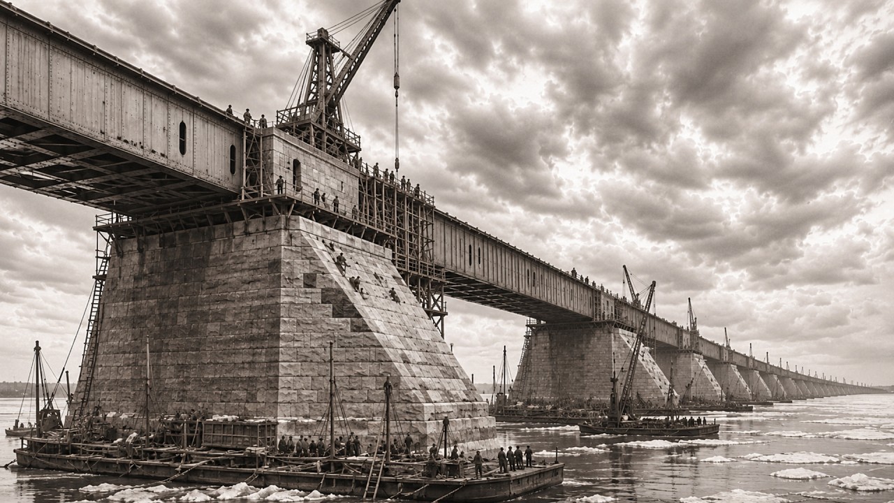
The existing locks could not be widened. New channels had to be cut through the rock and soil of the river valley to reach the required depth and width. Seven entirely new locks had to be built from the riverbed upward in concrete. And the Moses-Saunders power dam had to be constructed across the full width of the international section of the river between Massena, New York, and Cornwall, Ontario: a structure roughly 3,300 feet long, built in the bed of the St.
Lawrence, containing 32 generating units across its American and Canadian halves, producing a total power output that would make it the largest hydroelectric facility in the world upon completion. The excavation for the new seaway channels on the Canadian side moved 218 million cubic yards of material over the course of the project. The men who moved it did so with the largest construction equipment working anywhere on the continent in 1954: scrapers, bulldozers, dredges, draglines, and trucks. The dragline at the Iroquois control structure excavation carried a 200-foot boom.
Its bucket held 15 cubic yards of material per pass. The operator sat in a cab suspended 60 feet above the working face, reading the feel of the controls the way a craftsman reads his material: through the resistance in the hoist cable when the bucket hit clay versus broken limestone, through the slight tremor in the boom as the swing approached its limit radius, through the pitch of the engine under load. He knew when to push the bucket and when to pull it back from the sound the machine made before he could name the sound. That knowledge is not in the operator’s manual.
It accumulates through years of running equipment in specific materials and conditions, and it leaves the project when the operator does. Rock excavation required explosives. The limestone bed beneath the St. Lawrence Valley in the international section is Ordovician limestone: hard, consistent in its resistance, and consistent in its tendency to crack cleanly when drilled and loaded properly.
Drillers sunk blast holes at specified depths and spacings. Powdermen loaded each hole with powder and fuse, and fired them in sequences designed by blasting engineers to throw the broken rock into the excavation area, not into adjacent working zones. Understanding the rock at that level is not simply calculation. It is practical knowledge accumulated from firing blasts in a specific formation over enough years to see what that formation does when it breaks: how the limestone in the Wiley-Donderó channel differs from the granite they worked in northern Ontario, or the shale of the Pennsylvania coal fields, and making the adjustments in charge weight and hole spacing that those differences require.
The engineers set specifications from theory. The blasters adjusted them from observation. Between the two, the excavation progressed. The concrete required for the seven new lock chambers was about 6 million cubic yards across the entire project.
The lock walls were built using sliding forms: continuous pours in which the forms moved upward as the concrete hardened below, producing walls free of the cold joints that would have required waterproofing. A sliding pour for a lock chamber wall ran 24 hours a day until the wall was complete. The finishers who dressed the concrete as it emerged from the forms worked at night in St. Lawrence winter weather.
Massena, New York averages 32 days below zero Fahrenheit every winter, and the construction schedule did not stop for temperature. Fresh concrete had to be protected from freezing until it gained enough strength to survive without heat. The crews who kept the heating tents over fresh concrete through the midnight shifts in January were not doing skilled work in the traditional professional sense. They were doing essential work in the physical sense, the kind of work where any lapse at three in the morning cost the project the strength of a lock chamber wall that would bear the pressure of a 25,000-ton ship when the chamber filled.
The cofferdams that made dry excavation possible were temporary earth and rock structures built in the river to divert the current away from the working areas. Building a temporary dam in the St. Lawrence meant placing material in a current that ran 3 miles per hour in normal flow, faster during spring flood, over a bottom the river had shaped over 10,000 years, and that bottom moved in response to the obstructions placed in it in ways the hydraulic models predicted approximately and the river proved precisely. The men who placed rock fill from barges and tracked equipment on the river ice in winter, working on a surface of ice over a current that was trying to remove what they were placing, understood the difference between what would hold and what would not, with the logic of men who worked beside the consequences of miscalculation on every shift.
The ice surface they worked on was the same current that would take them if it gave way. The communities in the flood zone were not consulted about whether the project was a good idea. They were informed, through expropriation orders from Ontario Hydro, that the project was proceeding, that their land was required, and that compensation would be paid at values set by the authority. The compensation process ran on the project schedule, not on the circumstances of the residents.
The real estate agents who arrived in Aultsville, Farran’s Point, and Moulinette to negotiate settlements did so under expropriation authority, which meant the alternative to accepting the offered settlement was to pursue it through legal proceedings the residents could not afford while the corporation could. The settlements were not negotiated in any practical sense. They were announced and documented. The people of those communities had lived on that land for generations.
In some families, seven or eight generations, since the United Empire Loyalists who refused allegiance to the American republic after the Revolution had settled the north bank of the St. Lawrence under royal land grants in the 1780s. The farms in the flood zone were not abandoned or resettled land. They had been continuously worked by families who knew which fields stayed dry during an August drought and which ones the May flood covered; who knew where the channel shallowed enough for the flat-bottomed boats the river fishermen used, and where it deepened beyond their draft; who understood the river the way you understand a place your family has lived for 170 years.
That knowledge could not be transferred in a compensation settlement. Houses could be moved, and hundreds were, hauled by house-moving equipment to the new townsites Ontario Hydro had planned on high ground above the flood line. The knowledge of the place the house had stood on could not be moved. It was flooded along with the place.
Ontario Hydro’s relocation crews worked the flood zone from 1956 through the spring of 1958. Engineers and real estate agents identified which structures could be moved and which would be demolished. What could not be moved was torn down. The debris was burned before the water arrived.
There were 11 cemeteries in the flood zone. Work crews exhumed nearly 2,000 graves and reinterred them in new cemetery sites above the flood line. The names of the crews who did that work are in the payroll records of the contractors who employed them. They are not in the memorial materials of the Lost Villages Historical Society in Morrisburg, which holds the church pews, school photographs, and kitchen utensils that families carried out of those communities before the deadline.
That historical society was founded by the displaced people themselves, because they understood that the official record of the project would never contain what the official records of major infrastructure projects never contain: the price paid by the people who did not choose to be part of it. July 1, 1958 was named Inundation Day. The gates were closed, the water rose, and the streets of Aultsville sank in the order imposed by their elevations. The low ground went under first, then the higher ground as the level approached its target.
A church steeple was the last thing to disappear in one of the towns. The people relocated to the new townsites could watch, if they chose. Some did. Some did not.
The 22,000 workers at the peak of construction were not a homogeneous group. They represented the mid-century North American workforce, assembled for the largest civil project the continent had attempted since the Panama Canal. They came from the labor pools of the industrial Great Lakes cities, from the construction sectors of Quebec and Ontario, and from the Italian immigrant communities of Toronto and Montreal, which had supplied heavy construction labor to Canadian cities since the 1920s. They came from the Mohawk communities of Kahnawake and Akwesasne, whose ironworkers had been building bridges and high-rise structures in Canada and the United States since the cantilever arms of the Quebec Bridge began rising above its piers in 1907.
Mohawk ironworkers worked the seaway’s steel: the lock gates, the dam structure, and the transmission towers that carried Moses-Saunders power to the grid. They did the high steel work the job required, where the steel was heavy and the connections precise, and the height a worker could fall if he lost his balance depended on the structure at that moment. They knew what they were doing because their fathers had known it and taught them in the direct way that ironworking skill is passed down: through practice under supervision until supervision was no longer needed, because the worker knew what the work required. They are not on the interpretive signs at the Eisenhower Lock visitor center.
The concrete finisher who worked the sliding form walls at Snell Lock in January 1957 when the temperature at the site was 11 degrees Fahrenheit is not on the interpretive signs. The dragline operator who moved 15 cubic yards of St. Lawrence limestone per pass for two years in the Wiley-Donderó channel excavation is not there. The powder man who loaded the holes in the Ordovician limestone formation at six in the morning in a February when the thermometer in Massena recorded 19 degrees below zero is not there.
The house mover who hauled the frame houses of Moulinette up the temporary roads Ontario Hydro had graded to the new sites above the flood line is not there. They exist in the records, if those records still survive in readable form. The St. Lawrence Seaway opened on June 26, 1959.
The royal yacht Britannia, carrying Queen Elizabeth II and President Eisenhower, passed through the Iroquois Lock and continued downstream toward Montreal. The ceremony was precisely choreographed. The guest list was documented. The names of the guests appeared in the opening-day press coverage in Montreal, Ottawa, Washington, and New York.
The Mohawk ironworker who set the final bolts in the upper gate of the Iroquois Lock did not appear in that coverage. Neither did the surveyor who took the water reading on June 25, 1958 and recorded 238. 4 feet in his field book. The woman who watched her church steeple sink beneath the waters of Lake St.
Lawrence from the high ground of the new townsite did appear in the reports of local journalists who covered the inundation, if those reports were preserved, and some were preserved, in the libraries of the river towns that still stand above the flood line. The seaway handles roughly 40 million metric tons of cargo annually in its current operating state. The Eisenhower and Snell Locks pass ocean-going ships arriving from the Atlantic, bulk cargo carriers, and container ships drawing up to 26 feet. The ships pass through locks exactly 766 feet long and exactly 80 feet wide, built by men who worked through the brutal St.
Lawrence winters on a schedule set by governments that argued about the project for 50 years and then built it in five, because Canada told the United States it would build it anyway. The pool behind the Moses-Saunders dam is Lake St. Lawrence. It is a managed reservoir.
The operating level is maintained within a fraction of a foot of 238. 0 feet above sea level by the International St. Lawrence River Board of Control. On a morning when the pool is calm enough to reflect the sky, with the water 30 feet deep over the main street of Aultsville, Ontario, the surface gives no indication of what lies beneath it.
A river pilot aboard a downbound ship could not tell from the surface that the channel passes over a settled community. Navigation charts show depth contour lines. They do not show what those lines cover. The Lost Villages Historical Society in Morrisburg holds church windows, a school bell, butter churns, and family Bibles.
It also holds photographs of streets that are now underwater, taken by people who understood those streets were about to drown and wanted something of them to remain. It is the archive built by the displaced themselves because they knew the official archive of the project would not be built for them. The payroll records of the St. Lawrence Seaway Authority, and of the joint ventures of Walsh Construction, Perini, and Raymond International that built the project, sit in the archives that received those institutions’ papers when the project closed its accounts.
Some of those records have been cataloged. Some have not. None of them have been read in a way that would allow anyone to say, with the confidence that comes from examining original documents, who exactly set the waterslab on the upstream face of the Long Sault control structure in the spring of 1957, what he was paid, where he came from, and whether he finished the project in good health. Those men built the structure.
The structure still works. It moves 40 million tons of cargo a year through a route that had been commercially impractical for the entire industrial age before they built it. The structure is named for a politician who died before its opening. The politicians who authorized it are on the commemorative plaques at the lock entrances.
The engineers in charge are in the engineering records of the project. The 22,000 workers at the peak are in the account books. The river runs as it has always run, deeper now behind the dam, wider, slower, covering what it covers. The communities beneath the reservoir exist if you know where to look on a navigation chart.
The depth contours show the old channel, the old ridgelines, and the levels of the old roads over which the water settled on July 1, 1958, and from which it has not moved since. The people who were relocated exist in their new towns, or in their children, or their grandchildren, none of whom can fish the stretch of river their grandparents knew, because the stretch their grandparents knew lies under 30 feet of managed reservoir. The workers who built the structure that created the reservoir exist in the payroll records, in fading ink, in archives that may or may not be indexed in any form a researcher can browse. They built something that changed the commercial geography of an entire continent.
They are waiting to be looked at.
